Chapter 1
The Lay of the Land: Chinese and European World Maps
Chinese and European maps displayed divergent and sometimes overlapping mathematical, visual and functional aspects. European maps continued the tradition of Ptolemy, applying the mathematics of heavenly bodies to the Earth’s surface. Each point on Earth was made to correspond with an overlapped grid of latitude and longitude coordinates. In China, while the idea of a spherical Earth and the notions of latitude and longitude (the warp and the wheft) were used in astronomy and astrology, cartographers operated with different notions. Chinese maps assumed the Earth to be square and flat, covered by the canopy of heaven. Respecting certain principles of cartographic drawing, maps ensured accuracy by overlaying a grid specifying distances between points.

a)
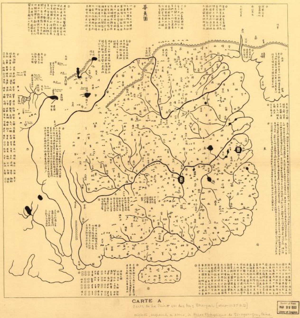
Figure 1.1. Map of thetracks of Yu Yujitu 禹跡圖 and Map of Chinese and foreign lands Huayitu 華夷圖. The map of the tracks of Yu consists of 5,110 grids, with each grid approximately 100 li. Original stone was engraved in 1136 A.D. These are stone rubbings of two sides of a stone stele. The stone is now in the Forest of Stone Steles Museum in Xi'an, China. Rubbings are from G7821.C3 1136.Y81 and .H8., US Library of Congress Geography and Map Division, Washington, DC. U.S.A.
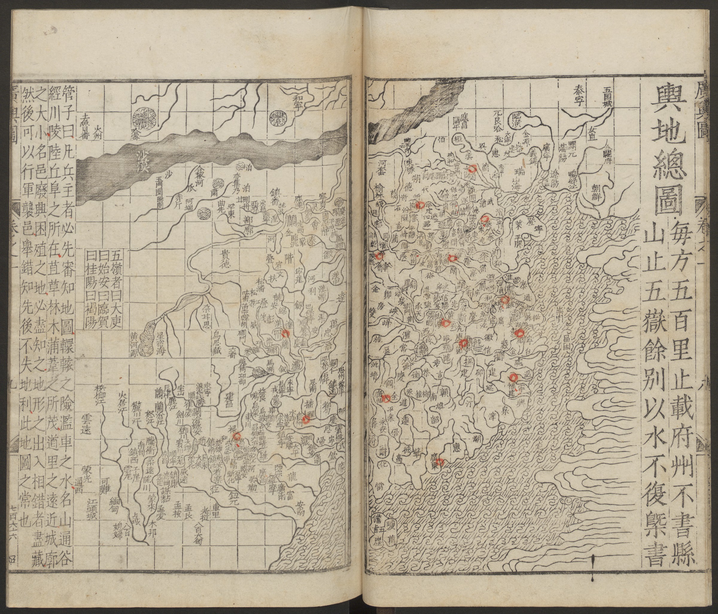
Figure 1.2. Luo Hongxian 羅洪先, General map from the Extended Terrestrial atlas Guang yutu 廣輿圖, 1566 edition. Yanching Library, Harvard University, Cambridge, MA, USA.
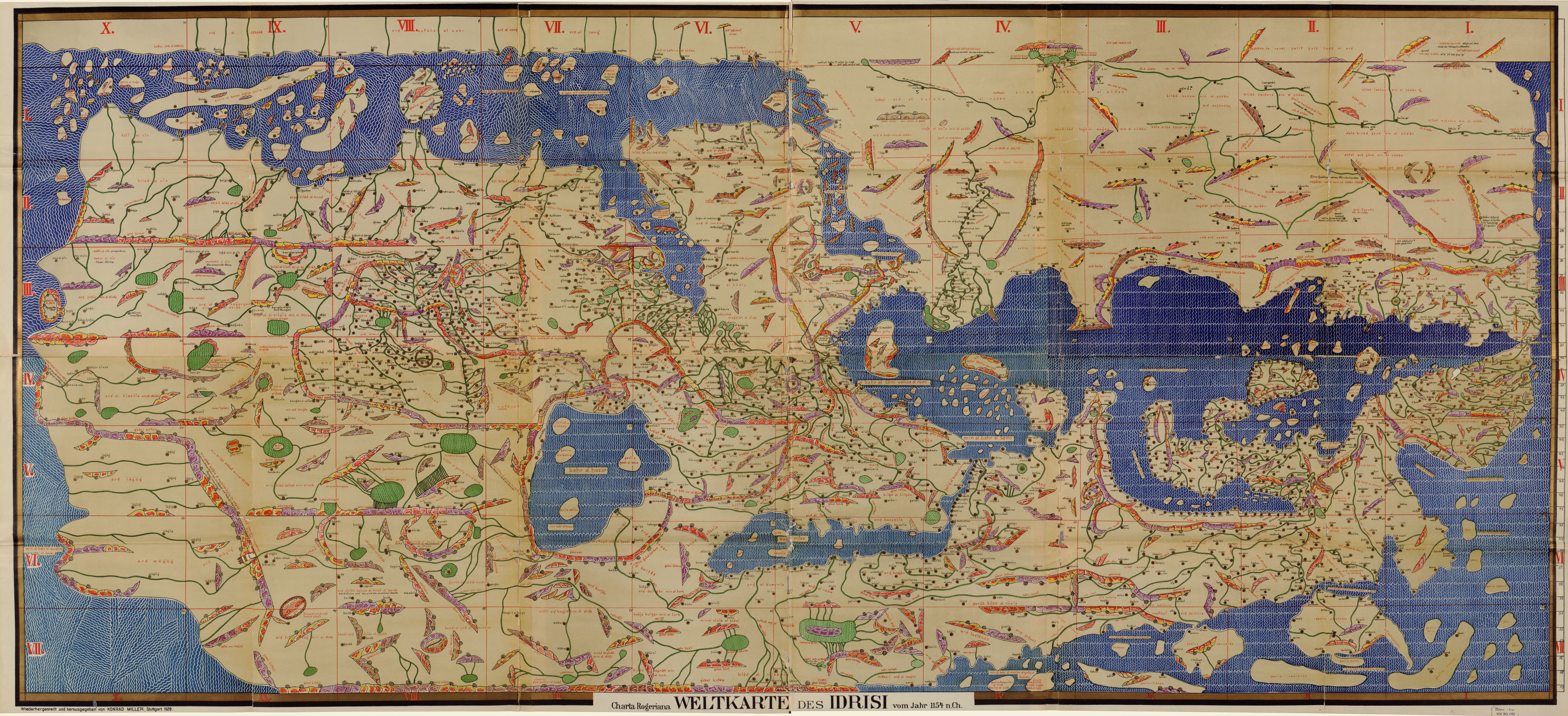
Figure 1.3 Muhammad al-Idrisi, Map of the World 1154 Kitab nuzhat al-mushtaq also known as Carta Rogeriana. Reconstructed by Konrad Miller, 1928. US Library of Congress G3200 1154 .I3 1928, Washington, DC, U.S.A.
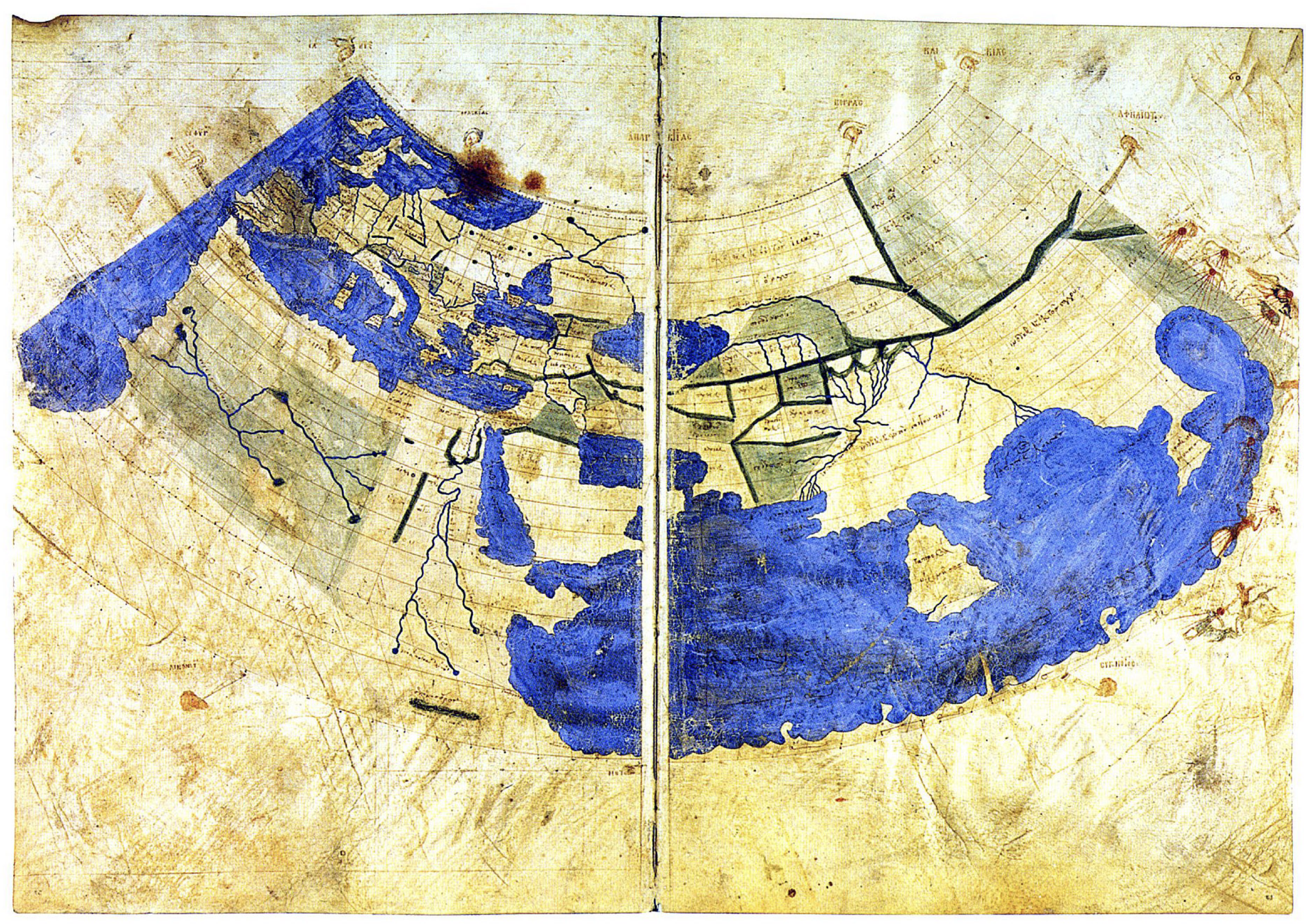
Figure 1.4 World map according to Ptolemy's conic projection. Codex Vaticanus Urbinas Graecus 82. Parchment 575 x 418 mm. Probably assembled by Maximus Planudes in Constantinople c. 1300; later in possession of Palla Strozzi (1372-1462), then with Federico da Montefeltro, Duke of Urbino. This was effectively the first Ptolemaic world map in Europe.

Figure 1.5 Gerard Mercator, Nova et aucta orbis terrae descriptio ad usum navigantium emendate accommodata (New and improved description of the terrestrial globe, adapted to the use for navigation), 1569. Harvard University Library, Cambridge, MA, U.S.A.
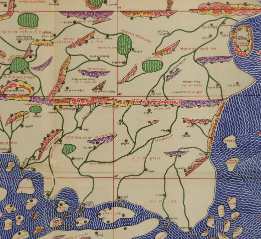
Figure 1.6 (Detail)Muhammad al-Idrisi, Map of the World 1154 Kitab nuzhat al-mushtaq also known as Carta Rogeriana. Reconstructed by Konrad Miller, 1928. US Library of Congress G3200 1154 .I3 1928, Washington, DC, U.S.A.
Chapter 2
Translation and Treason
Why were Chinese world maps translated in early modern Europe? This chapter answers this question by focusing on the story of the 1584 map of China Chinae, olim Sinarum Regio nova descriptio by Abraham Ortelius. This was the first popular and widely disseminated map of China and it was based on a translation from Chinese sources. In discussing this map, the chapter will cover the period between 1550 and 1584. It will argue that the European cartographic interest in China was motivated by the rivalry between Spain and Portugal around the controversy about a line stretching from pole to pole demarcating their territories in the Atlantic and Pacific Oceans.

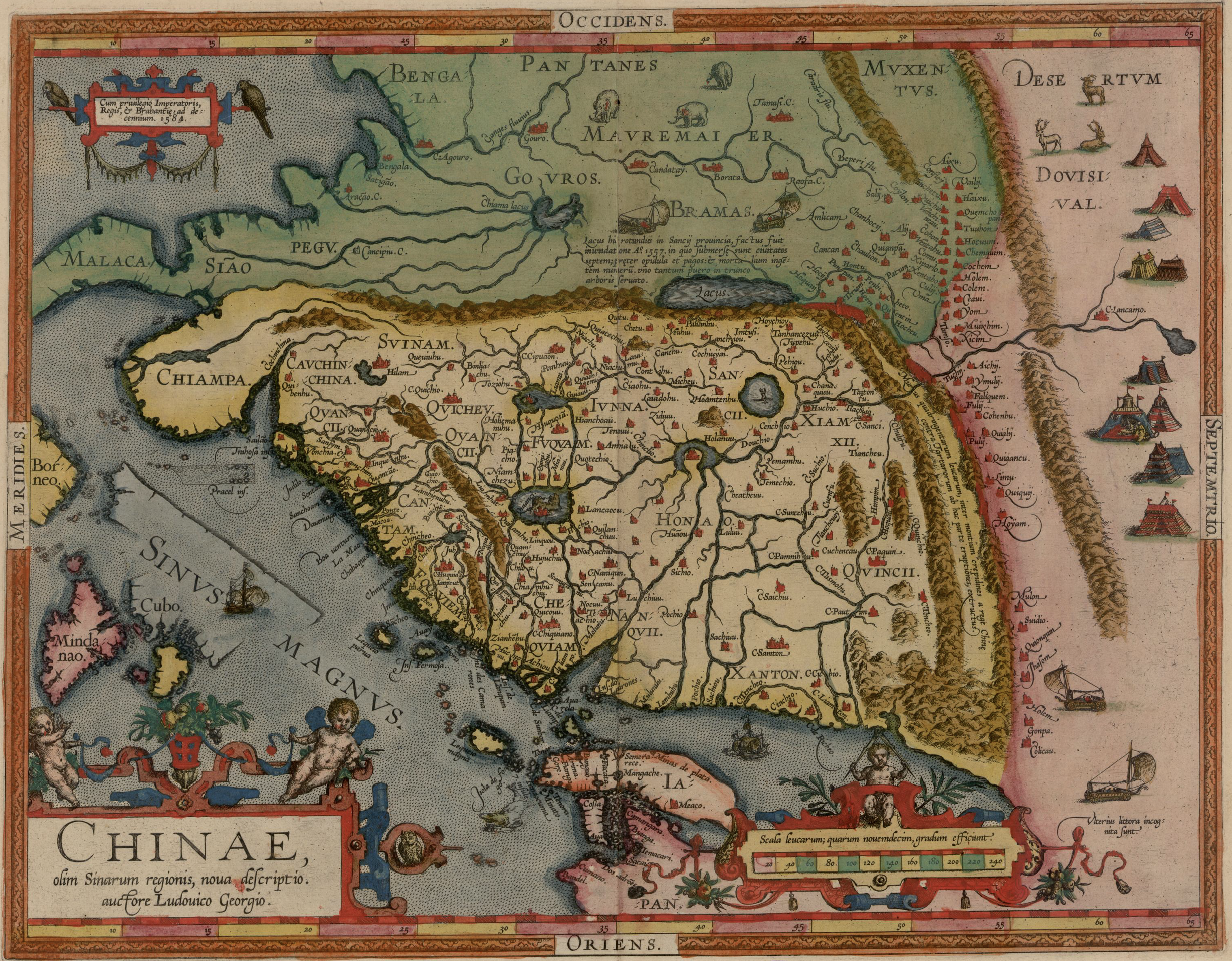
Figure 2.1 Abraham Ortelius, Chinae olim Sinarum regionis, nova descriptio auctore Ludovico Georgio (New description of the region of China authored by Ludovico Georgio). In Abraham Ortelius, Theatrum orbis terrarum, Atwerpen, Christophe Plantin, 1584.
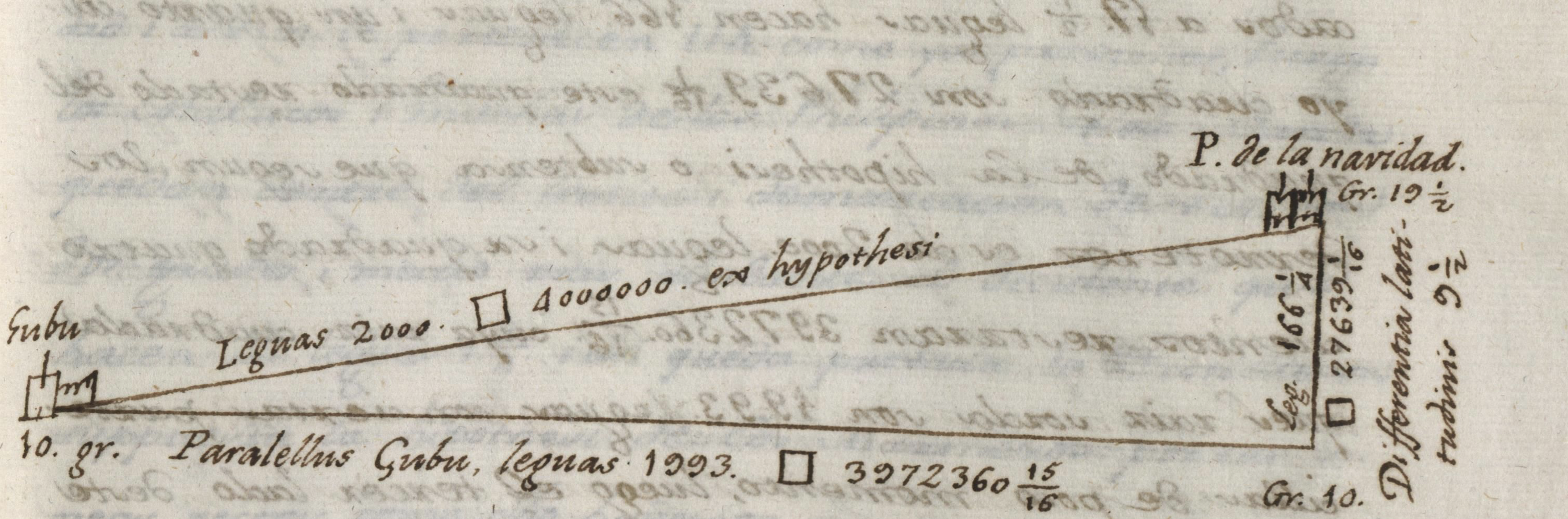
Figure 2.2 Drawing by Hieronimo de Chávez, 1566. Martimuñoz 09-04797, f. 331, RAH, Madrid, Spain. The drawing explains the conversion of distances from leagues in degrees of longitude and an effort to triangulate the distance between Cebu and the Port of Navidad in New Spain. The calculation was not impartial as it was part of an effort to extend the Spanish dominion. Mathematically it is problematic because it does not consider the curvature of the Earth
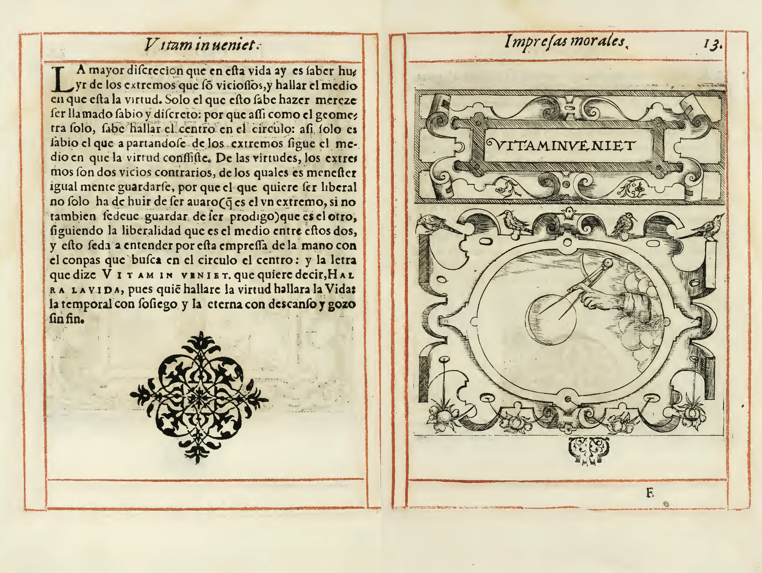
Figure 2.3. Juan de Borja, Empresas morales (Moral prints), Prague, 1581. The book of prints contains plates, each with a drawing representing a symbol related to a moral virtue or theme, as exemplified here. The accompanying text for each explains the topic in more detail.
Figure 2.4 Abraham Ortelius, Regni hispaniae. Comparison between the original 1570 edition and the newer edition sent by Ortelius to Spain.
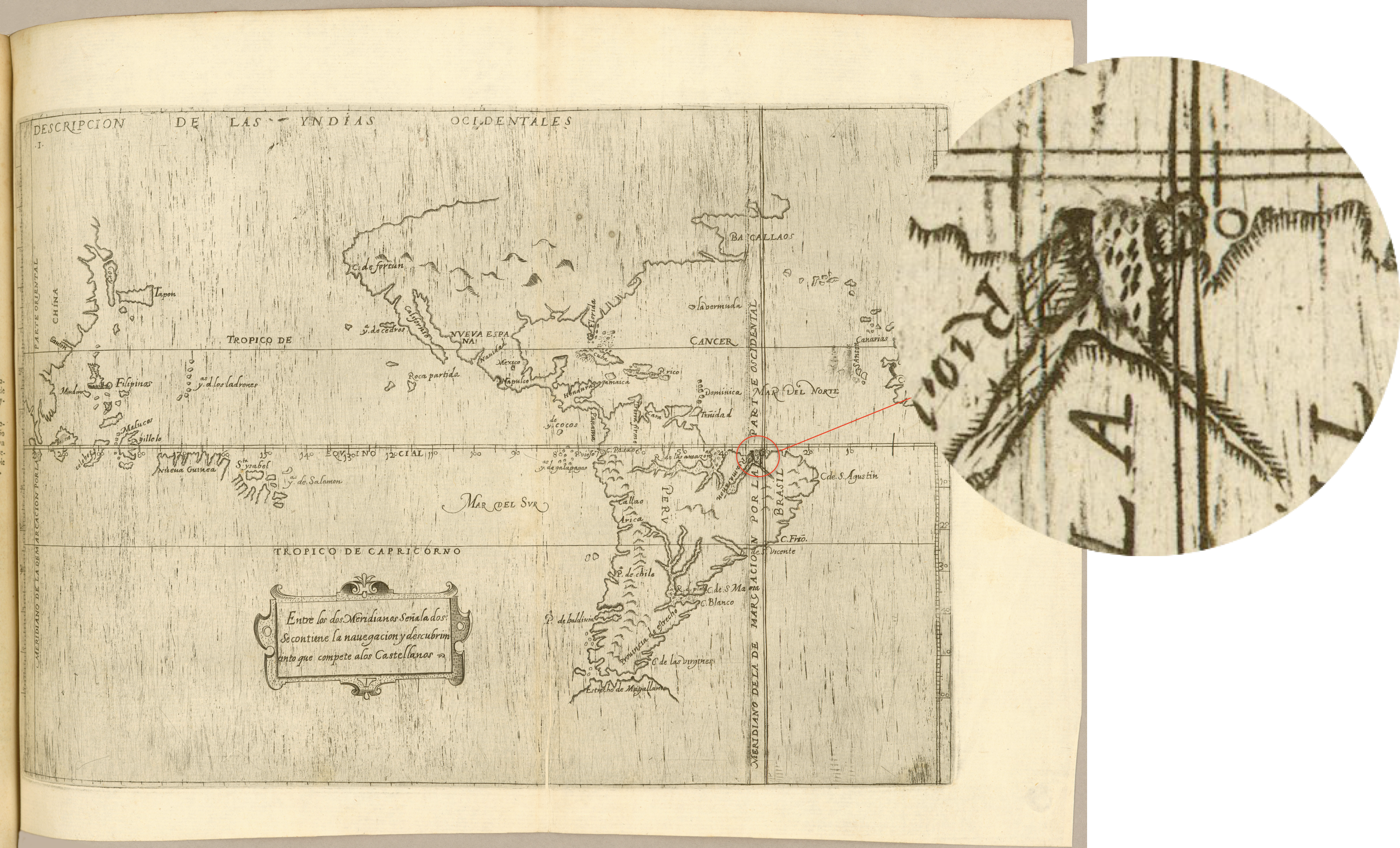
Figure 2.5 Juan Lopez de Velasco, Descripcion de las Yndias Occidentales (Description of the West Indies), from Demarcacion y division de las Yndias (Division and demarcation of the Indies), [Madrid, 1575], John Carter Brown Library, Providence, RI. This manuscript map portrays the Spanish view of demarcation in the wake of the colonization of the Philippines. Here, those islands, as well as a considerable part of China were set on the Spanish side. The manuscript also shows signs of modifications. The line on the Atlantic side was erased and moved 30 degrees to the right to reduce the Portuguese domain in Brazil.
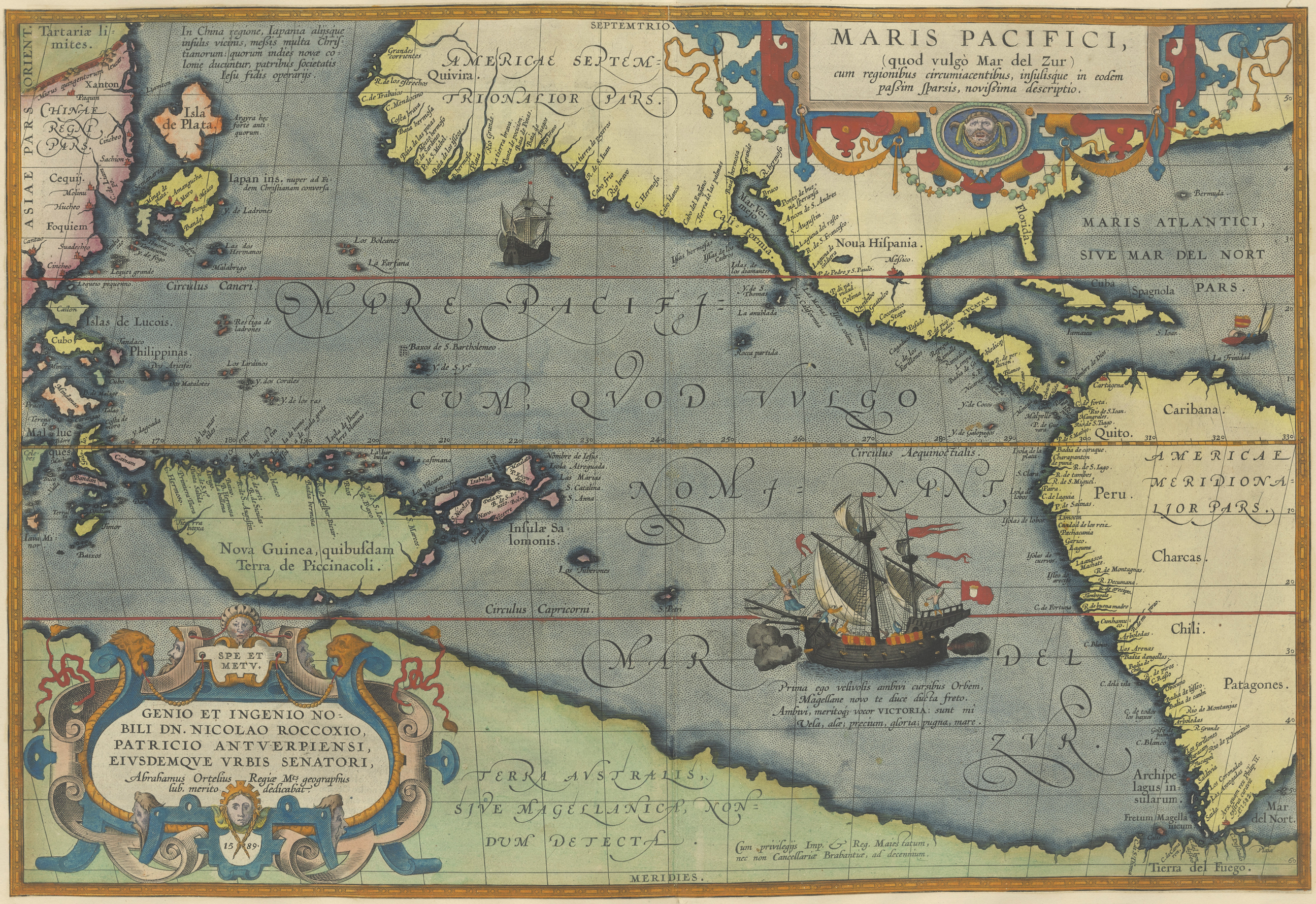
Figure 2.6 Abraham Ortelius, Maris Pacifici (quod vulgo Mar del Zur) (Of the Pacific Sea, that the people call Sea of the South). From Theatrum orbis terrarum, Antwerpen 1589.
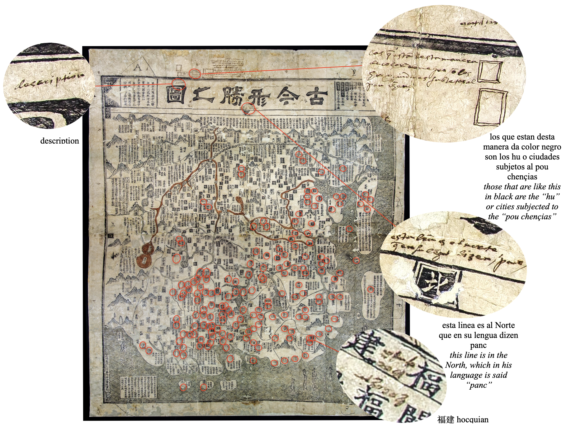
Figure 2.7. Historical and topographical map of China, Gujin xingsheng zhi tu 古今形勝之圖, 1555, Filipinas 5, Archivo General de Indias, Sevilla, Spain. Highlighted portions mark the places where inscriptions are made on the map. These fall in the following categories: place-names, the points of the compass, the title of the map, and explanations of the squares marking the capitals of provinces.
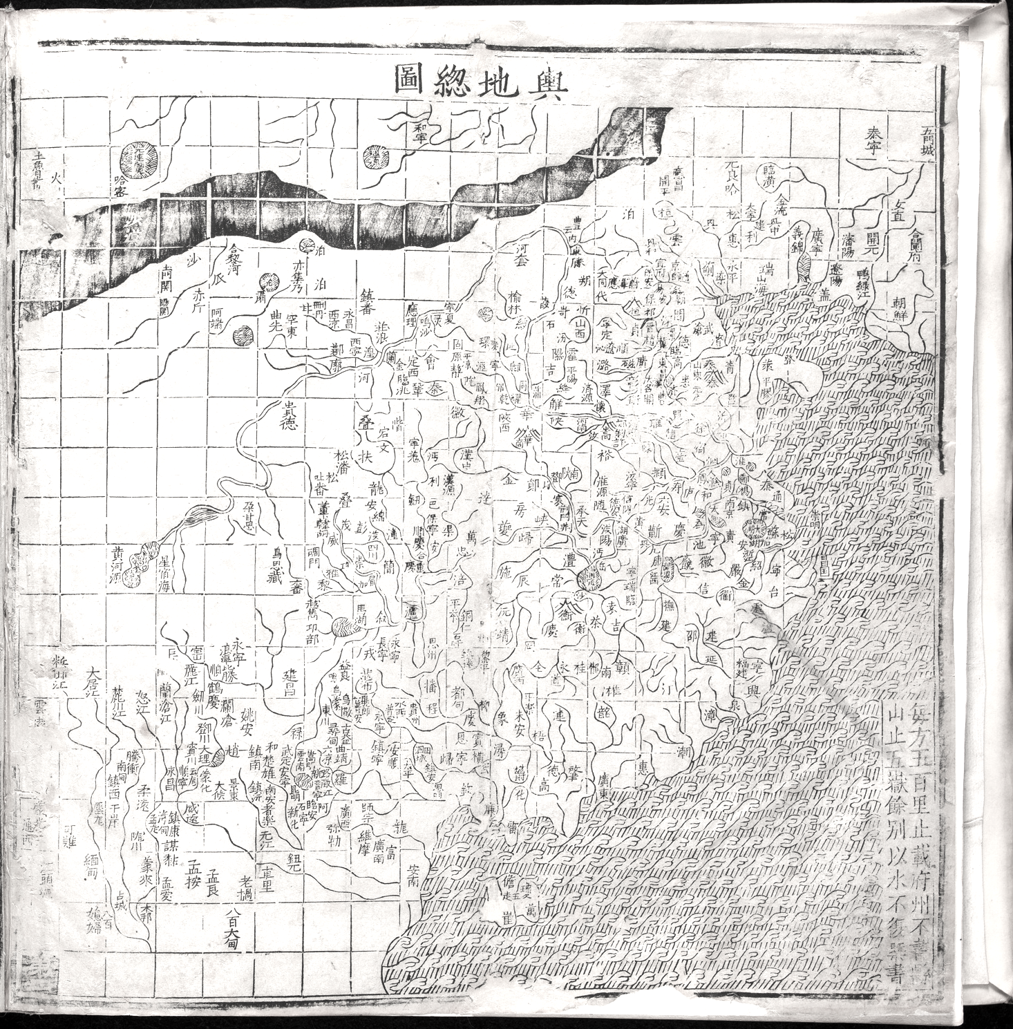
a)
b)
Figure 2.8a&b Top (a): General map of China (Yudi zongtu 輿地總圖) from Extended terrestrial atlas (Guang yutu 廣輿圖) by Luo Hongxian 羅洪先, 1555. National Library of China, Beijing. Bottom (b): Ortelius, Chinae, Antwerp, 1584 rotated.
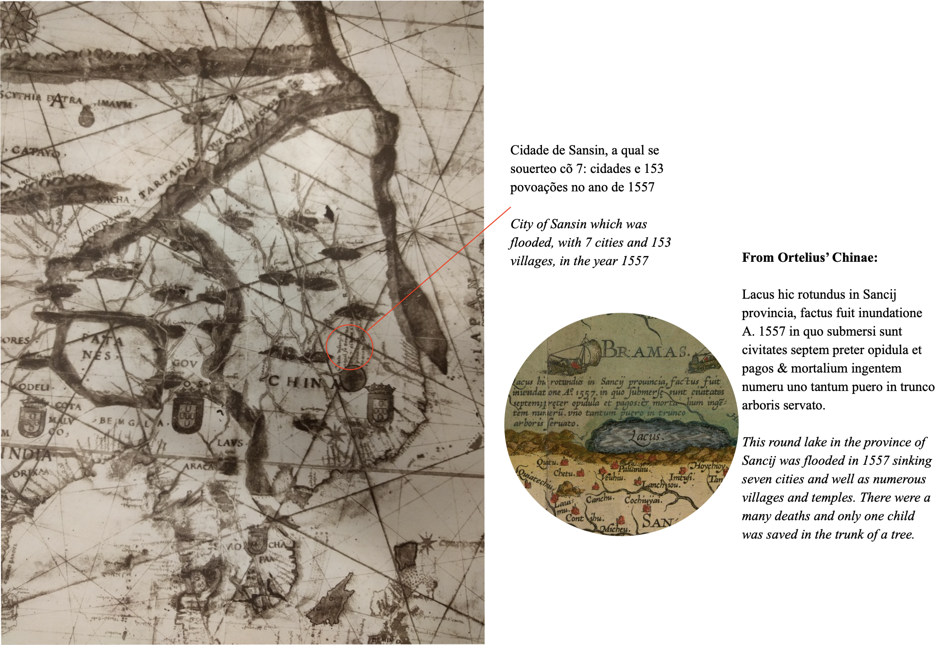
Figure 2.9 Bartolomeu Velho. Detail from his Chart of Asia, 1561. Museo di Storia della Scienza, Florence.

Figure 2.10 Map of myriad kingdoms of the Earth, 坤輿萬國全圖, by Matteo Ricci, Li Zhizao 李之藻, et al., 1604. A colored copy is in the Kano Collection, Tohoku University Library, Sendai, Japan. The highlighted portion shows the extent of the Spanish dominions as opposed to the Portuguese. China, the Philippines, and the Moluccas are firmly inside the demarcation that favored Portugal.
Chapter 3
The Westerner: Matteo Ricci’s World Map and the Quandaries of European Identity in Late Ming China
Focusing approximately on the period 1584-1610, this chapter addresses the contrasting question of the translation of European world maps in China. The chapter argues that the creation of Matteo Ricci’s world map, which was based on European and Chinese sources with text in Chinese characters and the use of Chinese printing methods and materials, was motivated by the need to create a new identity for Europeans in China; Matteo Ricci’s world map created “The Great West” as a geographical and cultural category. The chapter also explores the intricacies of cartographic translation and the back and forths between China and Europe, covering the activities of Michele Ruggieri and Matteo Neroni
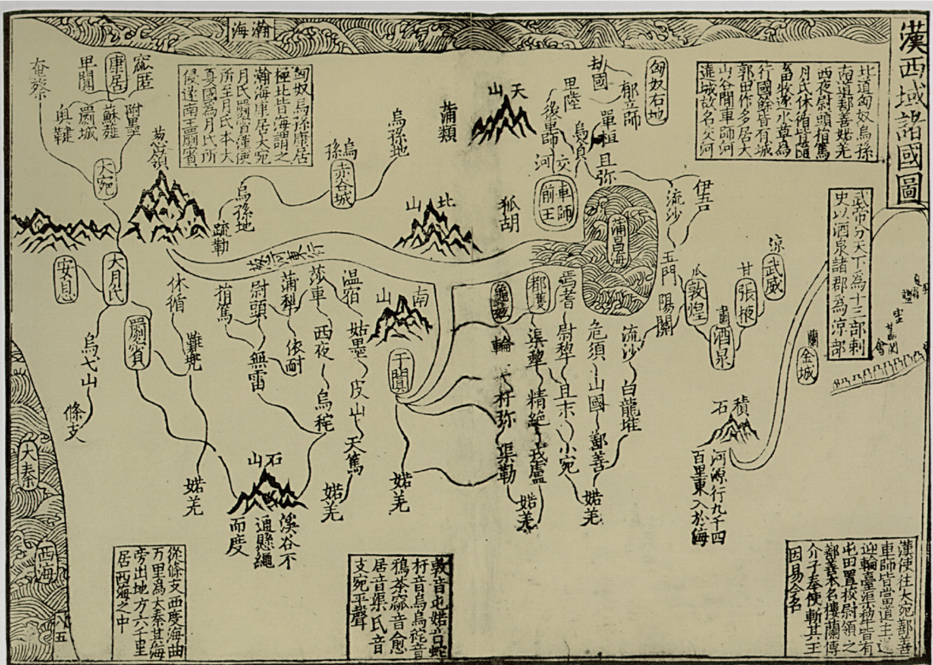
Figure 3.1 Map of Countries in the Western Regions of the Han Han (Xiyu zhuguo tu 漢西域諸國圖) from Fozu tongji 佛祖統紀 (General Records of the Founders of Buddhism), 32: 6. In the lower left corner, the map depicts the Western Sea 西海 and the Great Qin(Da Qin 大秦) —the Roman Empire of the East.
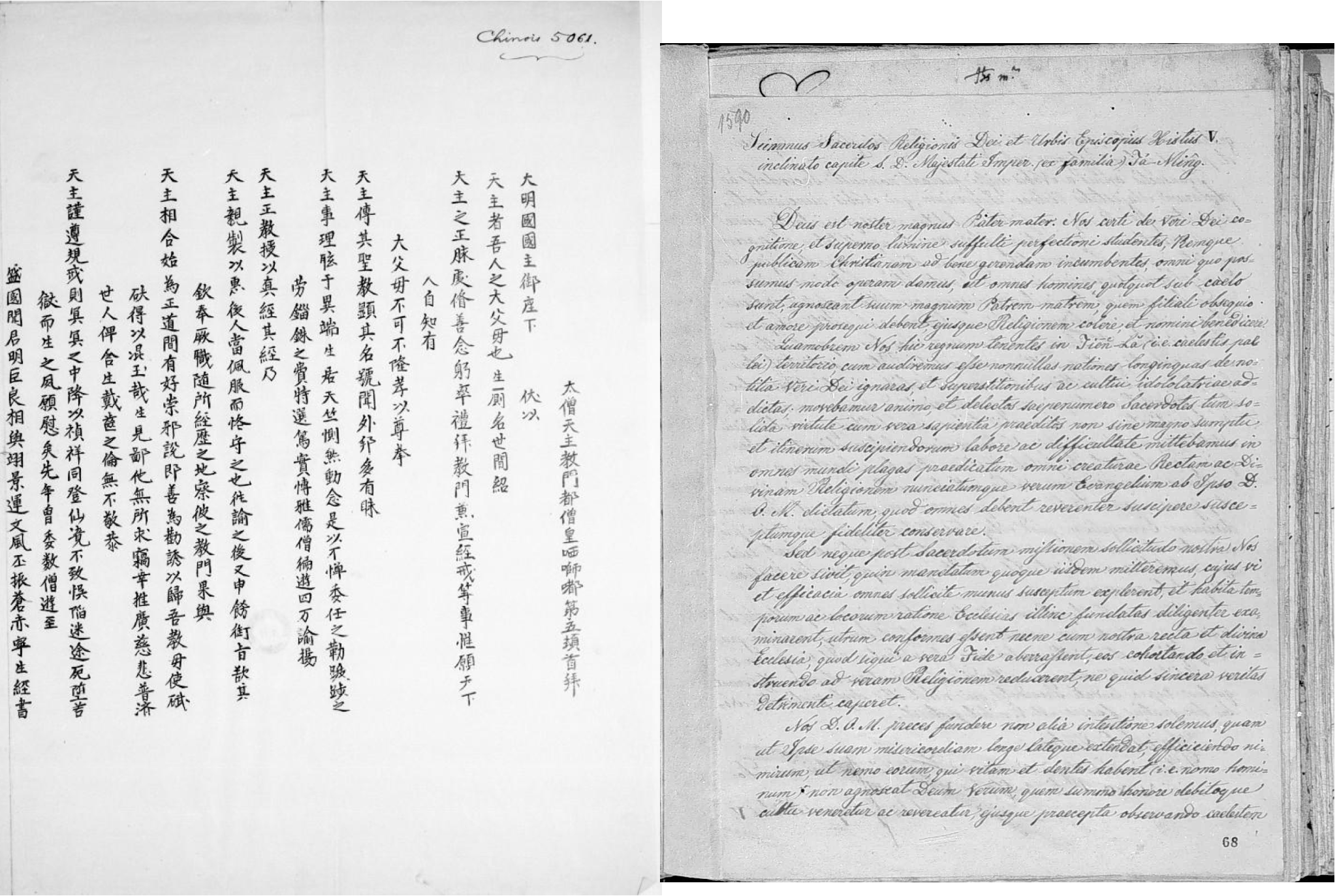
Figure 3.2 The papal later draft from Sixtus V to the Wanli Emperor. On the left: The Chinese versions composed by Matteo Ricci National library of France BNF Chinois 5061. On the right: The Latin translation. ARSI Jap.Sin. 125 68r.
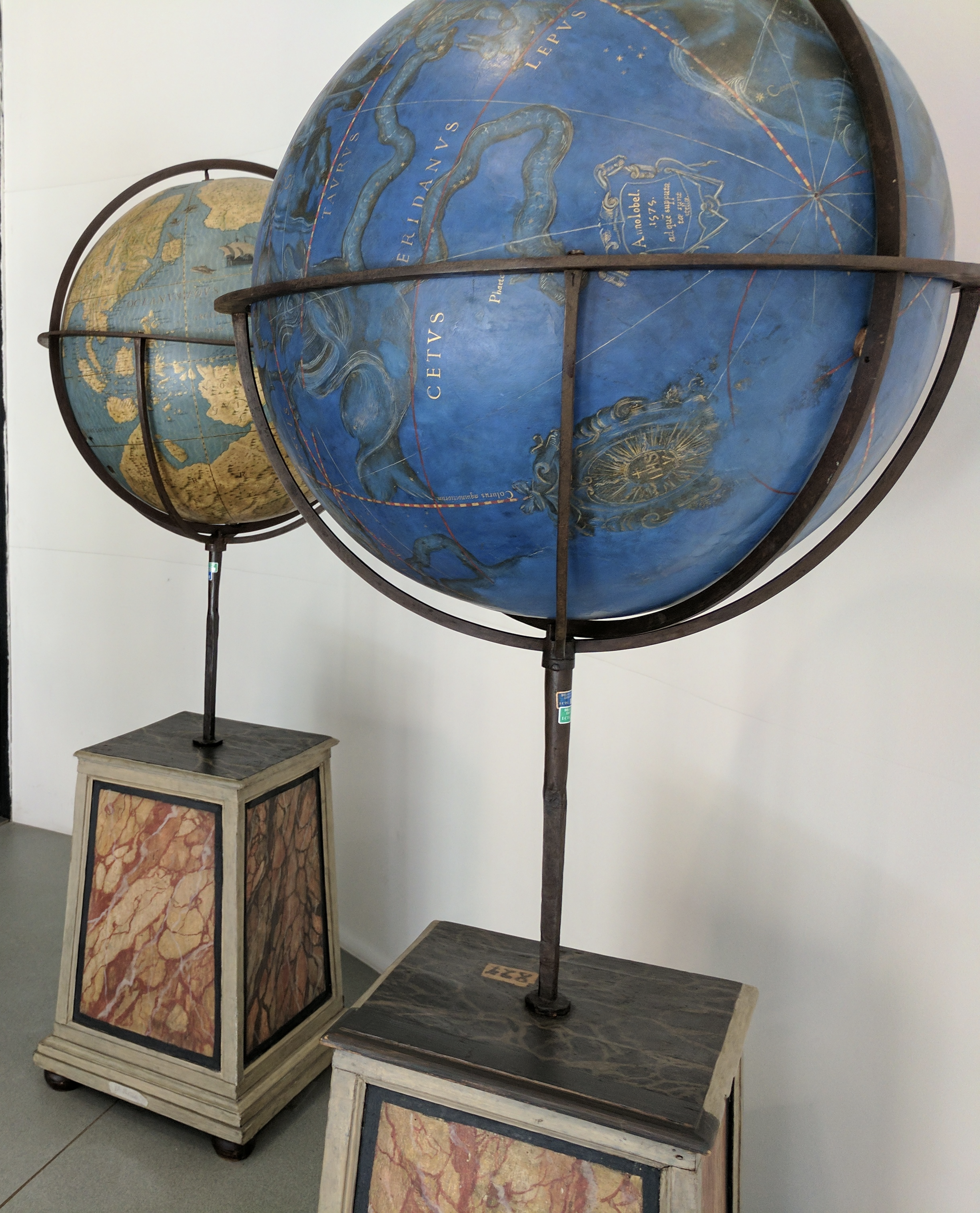
Figure 3.3 Pair of terrestrial and celestial globes by Matteo Neroni. Collezioni Speciali, Biblioteca Nazionale, Rome. The terrestrial globe features a cartouche indicating the date: Anno Jobel 1595. Photograph by the author.
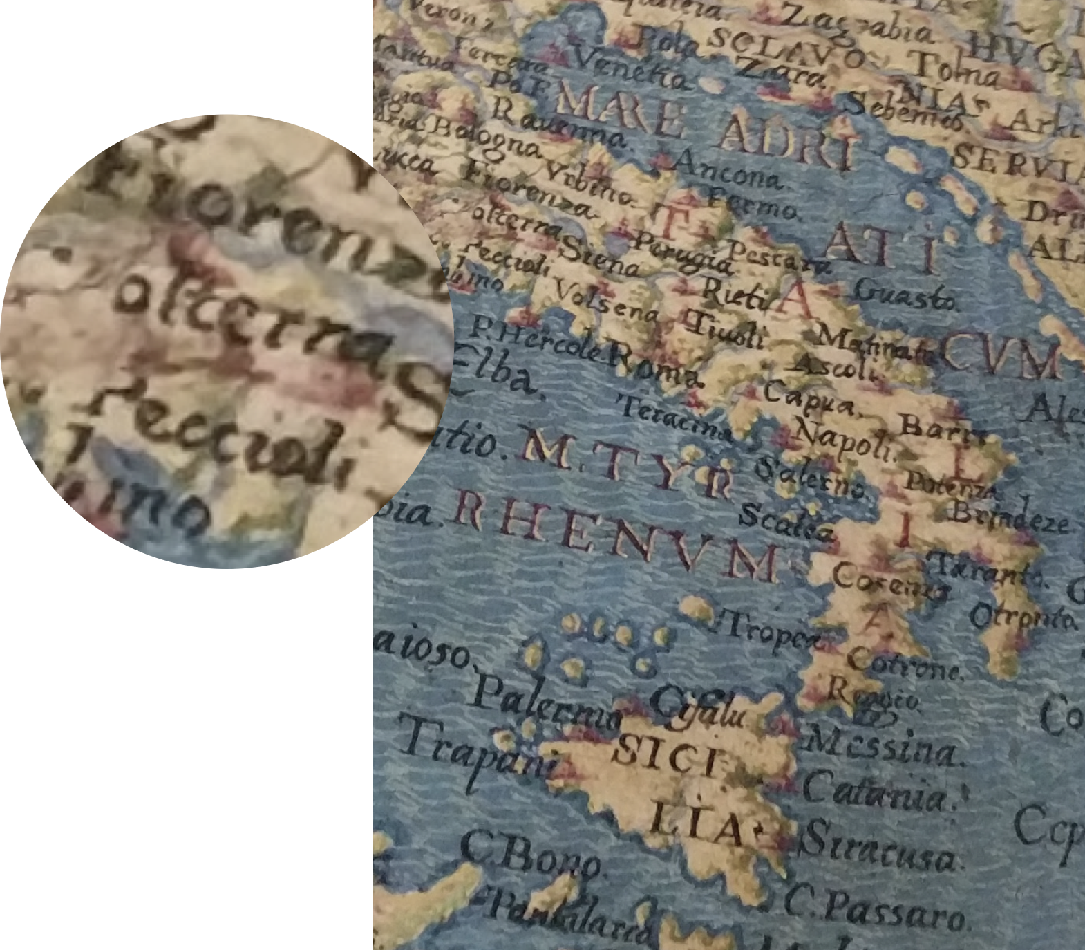
Figure 3.4 A selected portion of the terrestrial globe by Matteo Neroni (selection). From Collezioni Speciali, Biblioteca Nazionale, Rome, Italy. The map of Italy names Neroni’s birthplace the village of Peccioli and the larger town of Volterra to which Peccioli was subjected administratively.
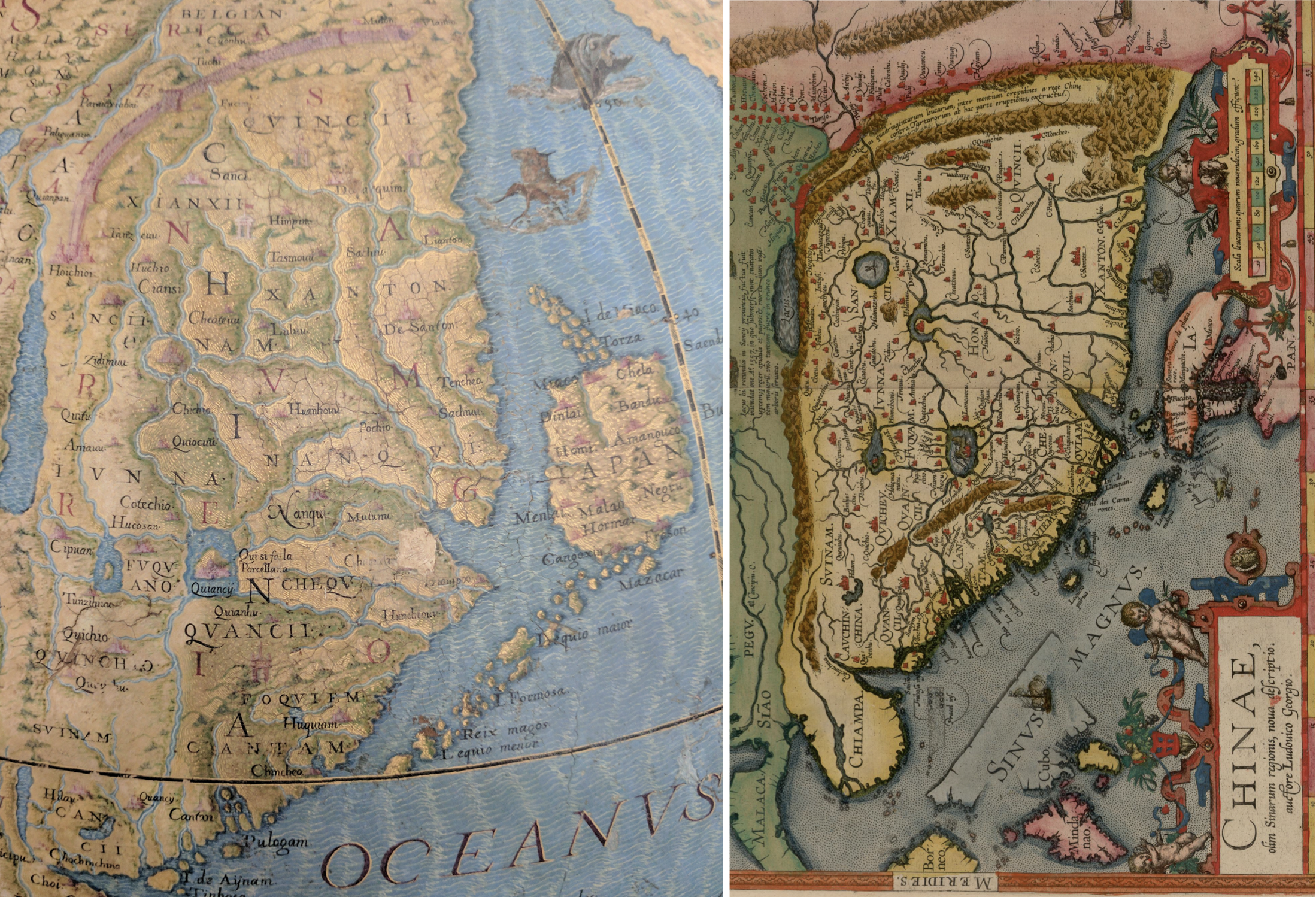
Figure 3.5 Left: Terrestrial globe by Matteo Neroni. Right: Ortelius, Chinae, 1584. The depiction of China on Neroni’s globe and Ortelius map from 1584 share as common source a now lost Portuguese map based on the Extended collection of terrestrial maps Guang yutu 廣輿圖 by Zhu Siben 朱思本.

Figure 3.6 Left: Terrestrial globe by Matteo Neroni BN, Rome. Right: Matteo Ricci & Li Zhizao, Map of Myriad Kingdoms, Colored Edition (1608) Nanjing Palace Museum 南京博物院. The Neroni globe and Ricci’s world map share a common depiction of Africa and equivalent naming of the Oceans.
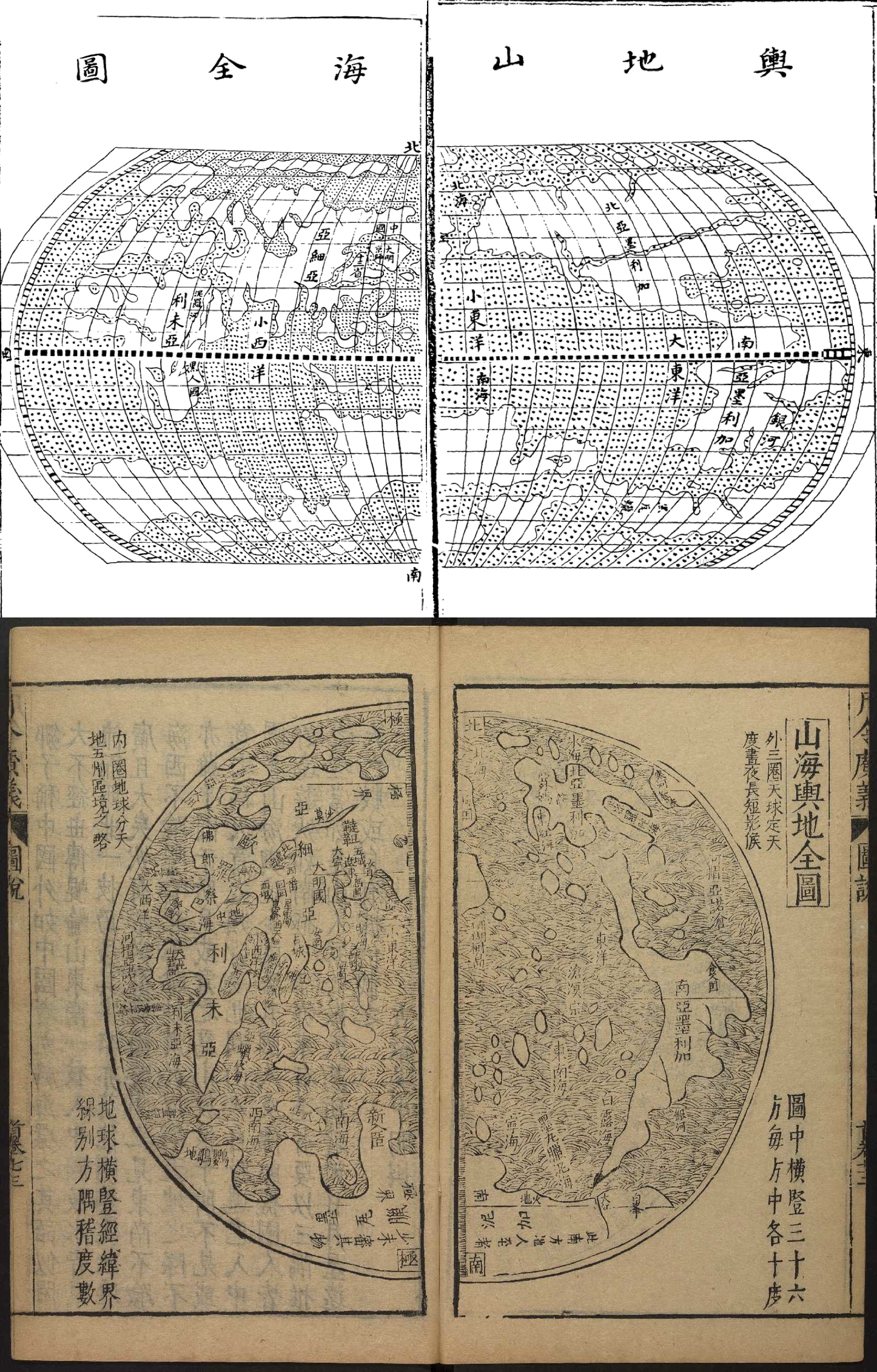
Figure 3.7 Top: Yudi shanhai quantu 輿地山海全圖 (Complete terrestrial map of the mountains and the seas) in Zhang Huang 章潢, Tushubian 圖書編 (Collection of maps), 1584. Harvard University, Yenching Library USA. This reproduction of Matteo Ricci’s 1584 world map names all the continents except Europe. The Western Ocean 大西洋 is also absent. Bottom: Shanhai yudi quantu 山海輿地全圖 from Feng Yingjing 馮應京, Yueling guangyi 月令廣義 (Monthly ordinances). Harvard University, Yenching Library. This reproduction of the 1600 Nanjing version of Ricci’s world map is the first to list the name of Europe and the Western Ocean. The map was later widely disseminated as part of the popular Ming encyclopedia 三才圖會 (1609).
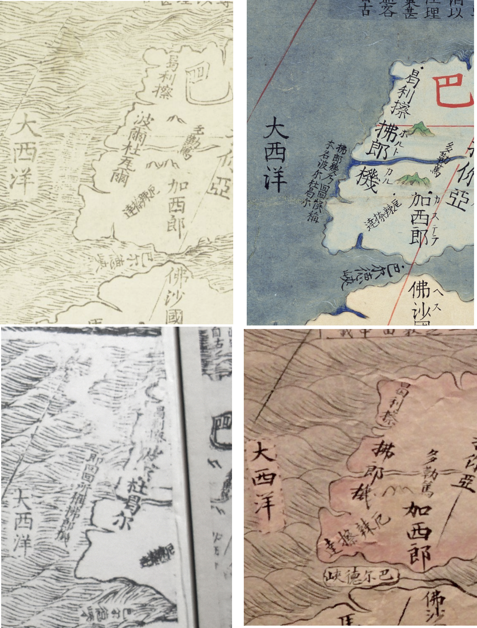
Figure 3.8 Top: 1.Matteo Ricci, Li Zhizao and Zhang Wentao, Kun Yu Wanguo Quantu different versions. From left 1. James Ford Bell Library Minesota altered 1602 version. Name of Portugal appears as Boerduwaer, explanatory note show marks of deletion from woodbloks. 2. Miyagi prefecture modified original version, before tampering.
Chapter 4
Material Matters: The Manchu Translation of the 1603 World Map by Li Yingshi and Matteo Ricci in the Later Jin State
Matteo Ricci’s entry into China at the end of the sixteenth century coincided with broader changes in the regional power dynamics of East Asia. Ming China was entering a period of dynastic decay. It was plagued by economic problems and pressed by the Manchus, a peoples from beyond the Great Wall. Chapter 4, covering the turbulent Ming-Qing inter-dynastic transition period between 1610 and 1644, tells the story of a version of Matteo Ricci’s world map, which was appropriated by the Manchus as they were forming their own identity and were planning to invade China. The chapter shows that the Manchus, coming in contact with Ricci’s world map created a practice of translation which they then applied to Chinese maps.
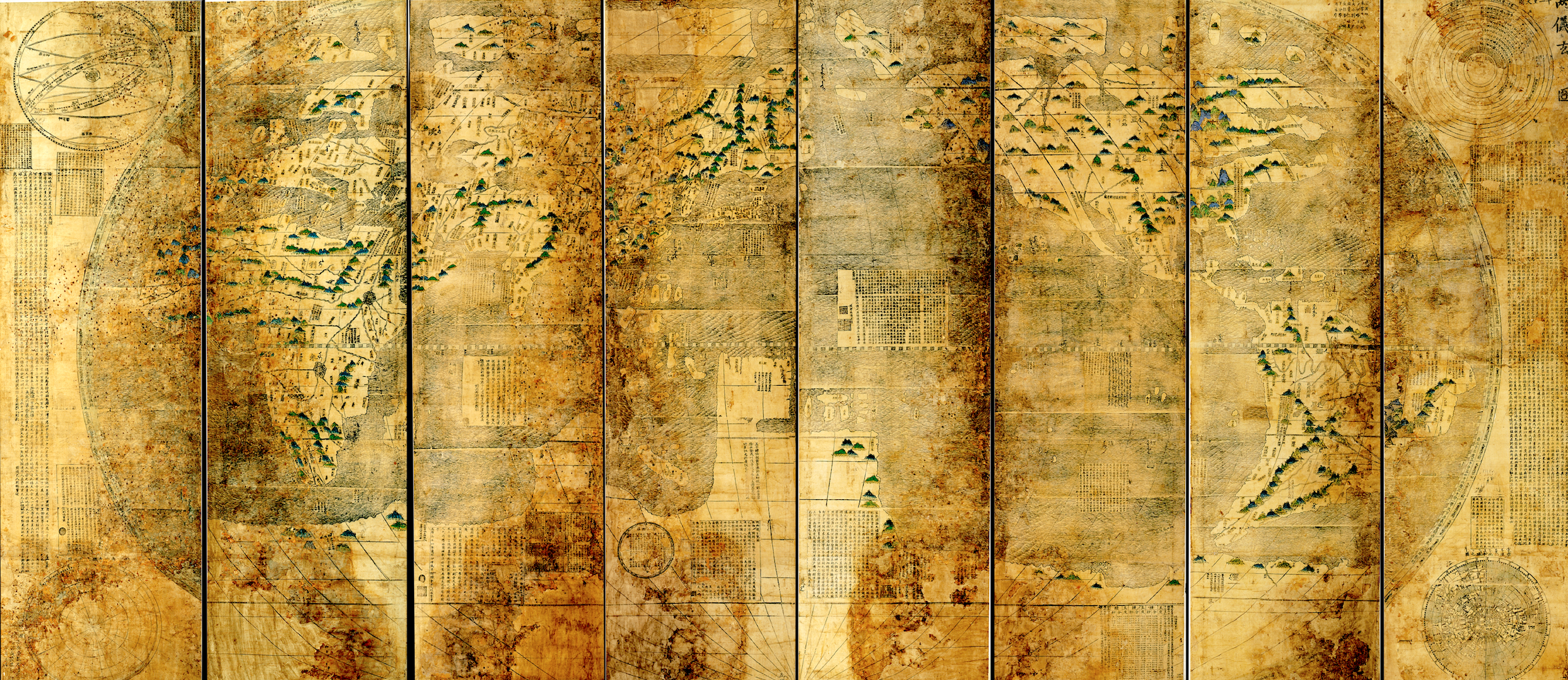
Figure 4.1 Li Yingshi and Matteo Ricci, Map of observing the mysteries of the Heaven and the Earth, 1603, Liaoning Provincial Museum 辽宁省博物馆, Shenyang, P.R.C.
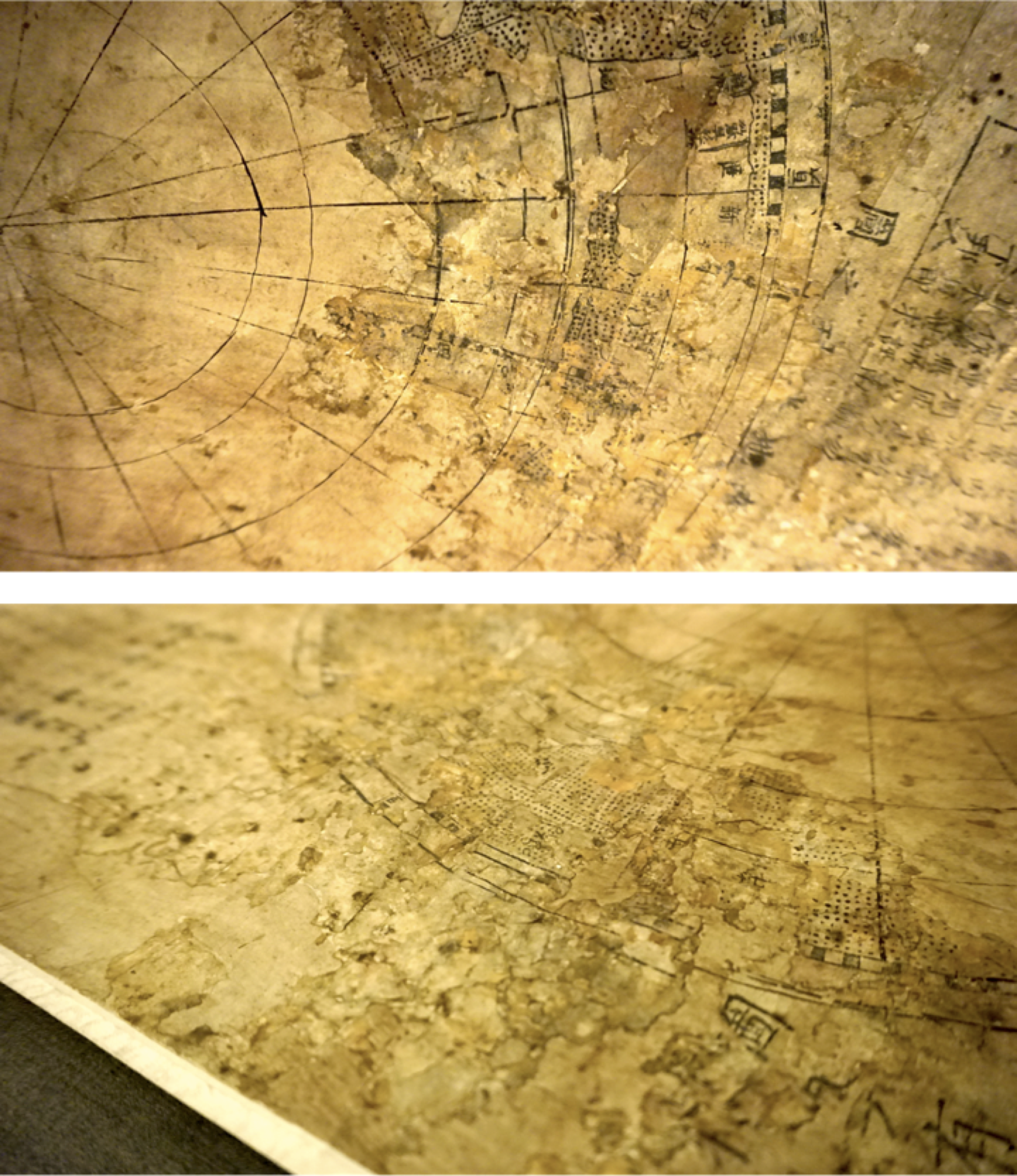
Figure 4.2 The left corner of the eighth roll of the Shengyang copy of the Map of observing mysteries. This area, representing the Southern Hemisphere, was damaged and later repaired. An artisan had applied paper paste and, after it dried, redrew the meridians to give the impression of continuity. Further damage to the map reveals the discrepancy between the two layers.
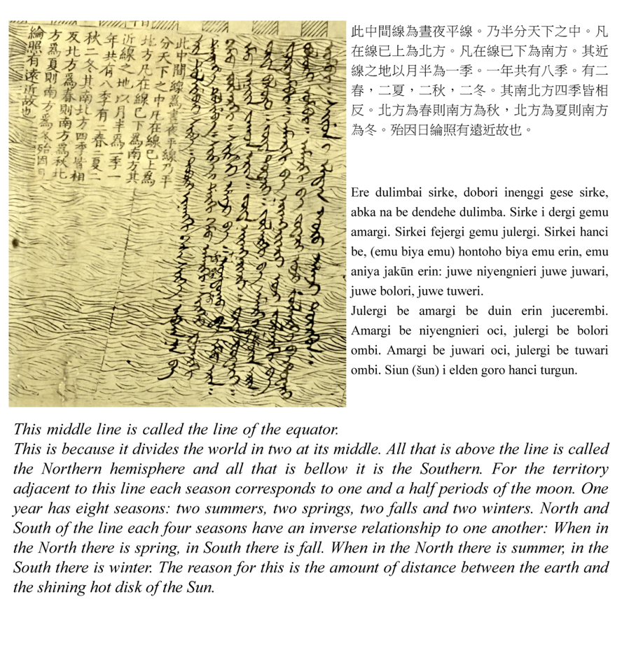
Figure 4.3 Manchu translation of the cosmological theory in a cartouche placed near the line of the equator in Map of observing mysteries, by Li Yingshi and Matteo Ricci, 1603

Figure 4.4a &b Map of observing mysteries. Manchu inscriptions on the map.
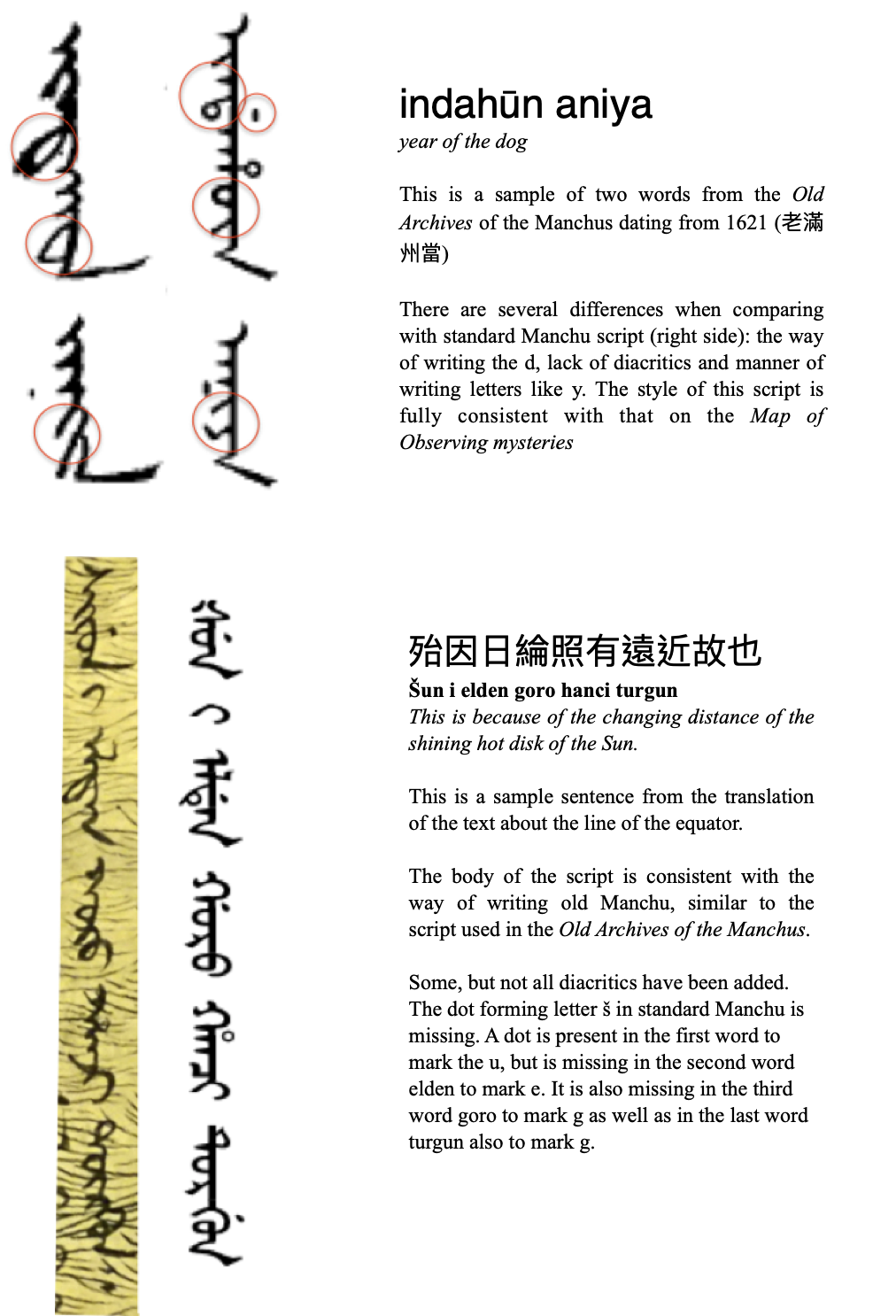
Figure 4.5 Analysis of the map’s Manchu script written on the Map of observing mysteries.
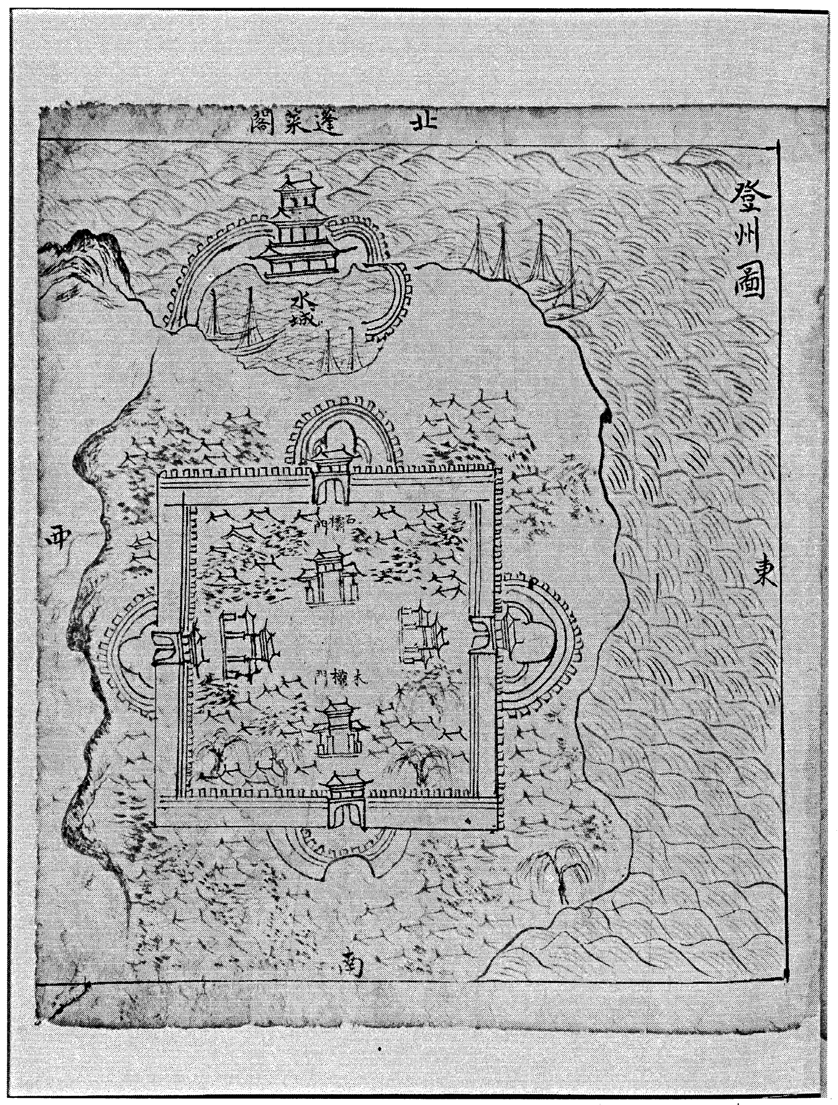
Figure 4.6 Map of Dengzhou鄧州 from Cartographic Diary of the Embassy to the Ming Court (朝天記地圖), by Chong Tuwon, 1630. Courtesy of the Kyujanggak Institute for Korean Studies, Seoul, South Korea. Chong Tuwon authored this volume of maps of places near the Bohai Sea between China and Korea. The map of Dengzhou from this volume was made in the style of Chinese cartography that was prevalent around the time that Chong met Rodrigues.
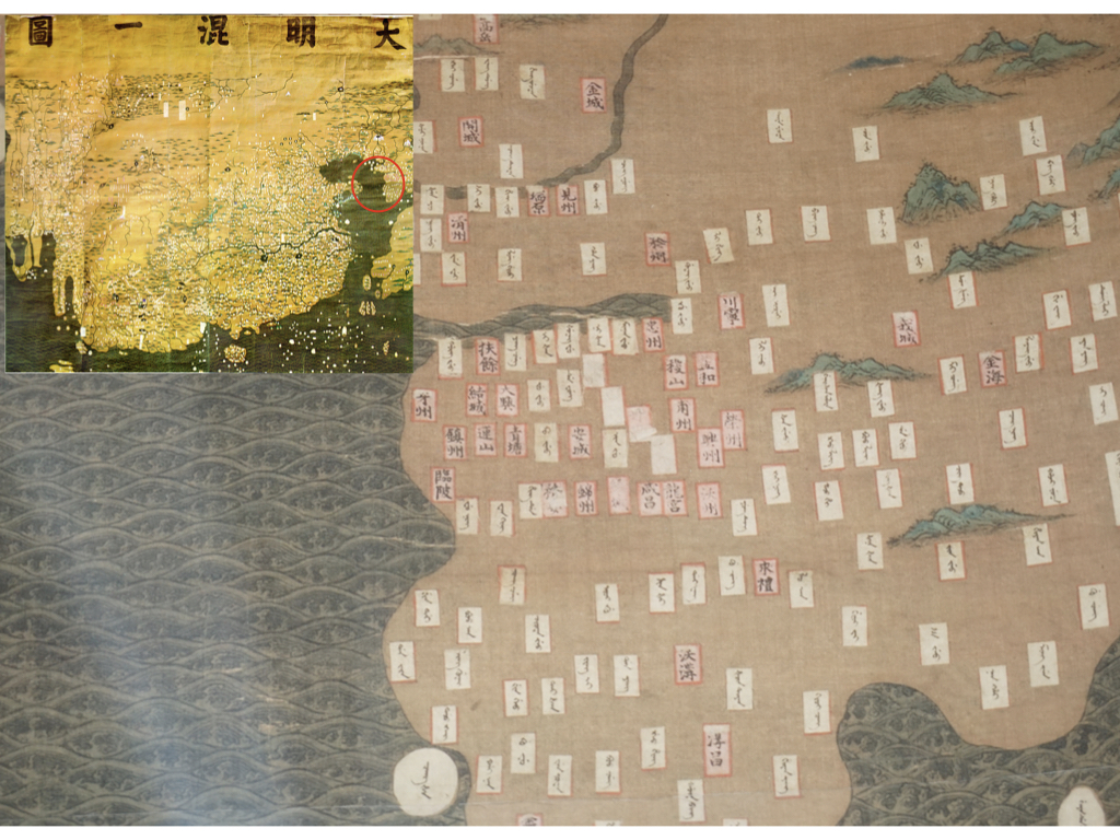
Figure 4.7 Synthetic map of the Great Ming, Da Ming hun yi tu大明混一圖, original in First Historical Archives, Beijing, reprint in Zhongguo Gudai Ditu Ji中国古代地图集 (Beijing, 1990). Facsimile from the Shanghai Museum of Navigation 航海博物馆. Photograph by the author. This section of the map of the Great Ming depicts the western portion of Korea and displays the Manchu place-name transliterations on affixed labels. In some places, over time, the labels have detached, revealing the original Chinese text underneath.
Chapter 5
At the Limits of China: How Borders Travelled the World
Matteo Ricci’s entry into China at the end of the sixteenth century coincided with broader changes in the regional power dynamics of East Asia. Ming China was entering a period of dynastic decay. It was plagued by economic problems and pressed by the Manchus, a peoples from beyond the Great Wall. Chapter 4, covering the turbulent Ming-Qing inter-dynastic transition period between 1610 and 1644, tells the story of a version of Matteo Ricci’s world map, which was appropriated by the Manchus as they were forming their own identity and were planning to invade China. The chapter shows that the Manchus, coming in contact with Ricci’s world map created a practice of translation which they then applied to Chinese maps.
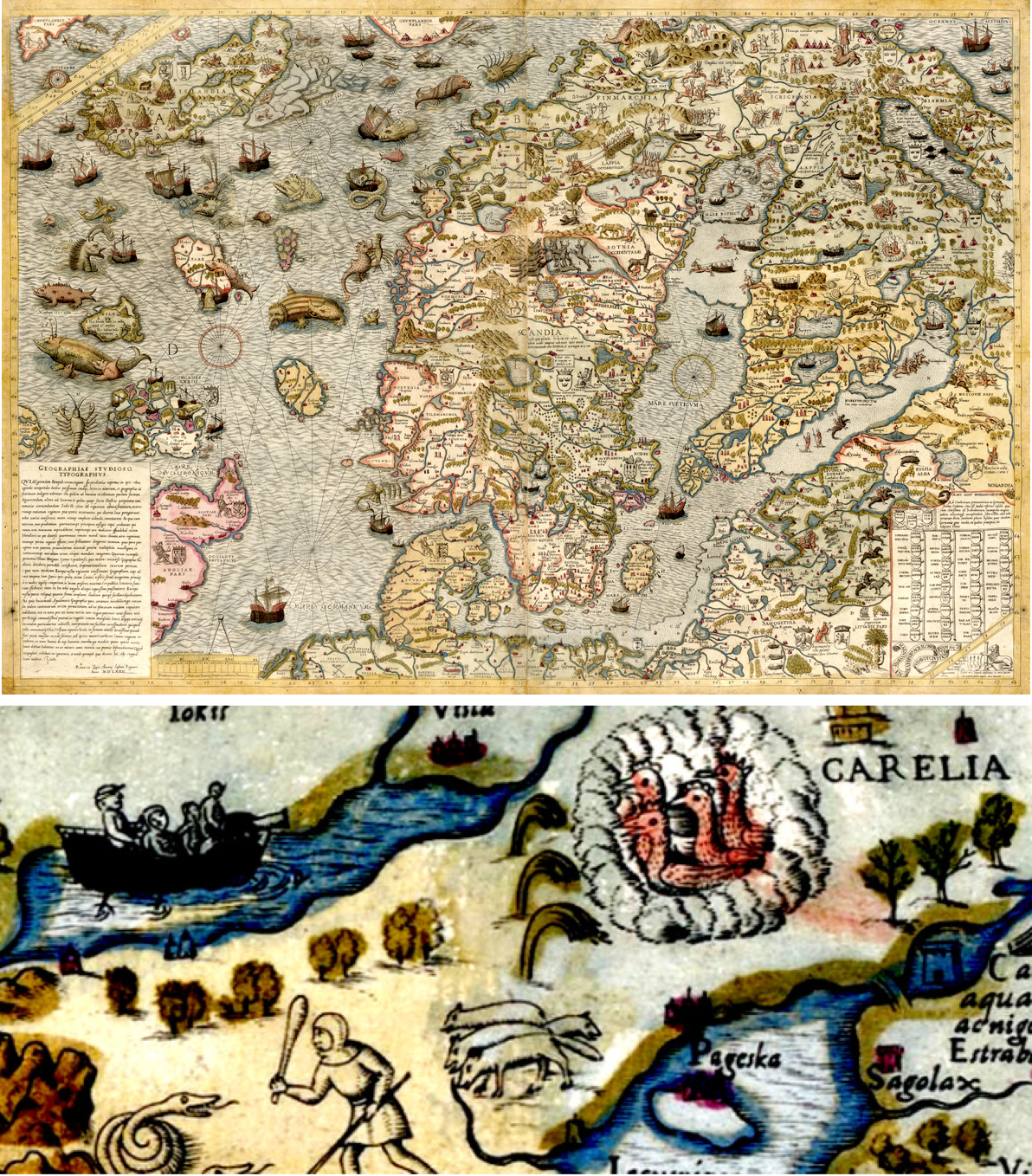
Figure 5.1 Olahus Magnus, Carta Marina, Antonio Lafreri, 1572. National Library of Sweden, Stockholm, Sweden. Top: View of the entire map, focused on northern countries. Bottom: Selection showing an example of the demarcation between two state entities.
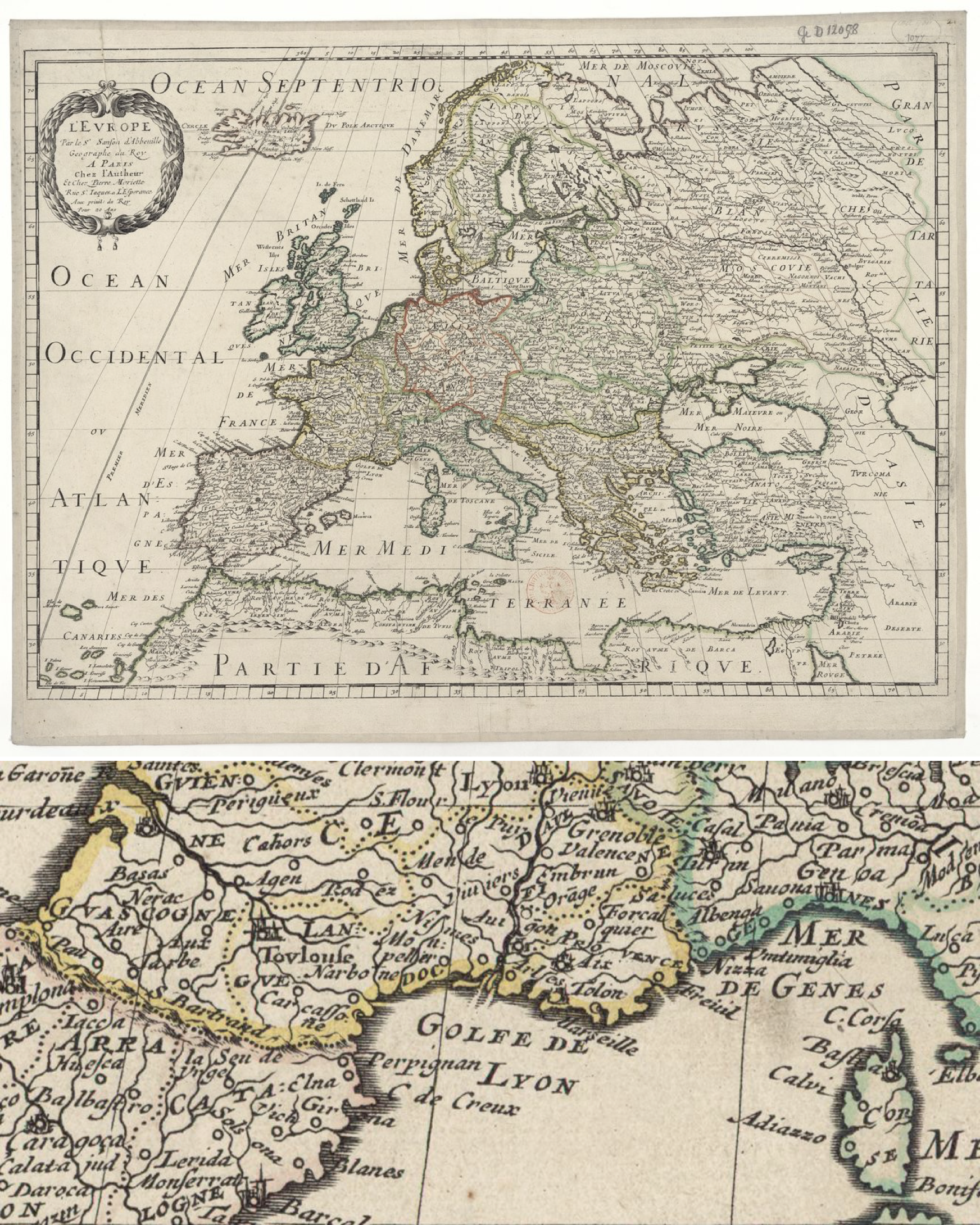
Figure 5.2 Nicolas Sanson d’Abbeville, L’Europe, Pierre Mariette, 1651. National Library of France, Paris. Top: General view of the map. Bottom: Selection showing the divisions between Spain, France, and Italy.
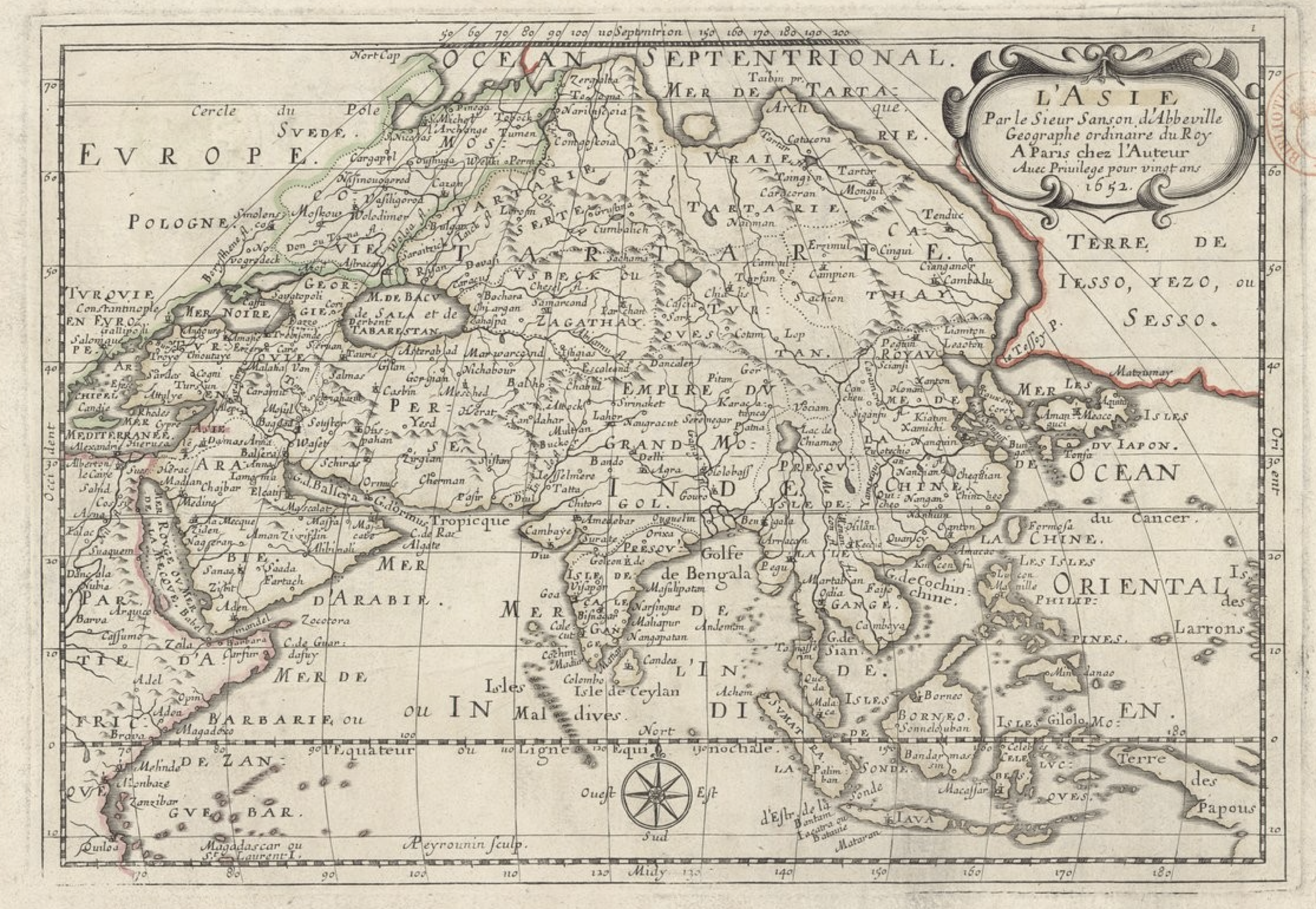
Figure 5.3 Nicolas Sanson d’Abbeville, L’Asie, Paris 1652
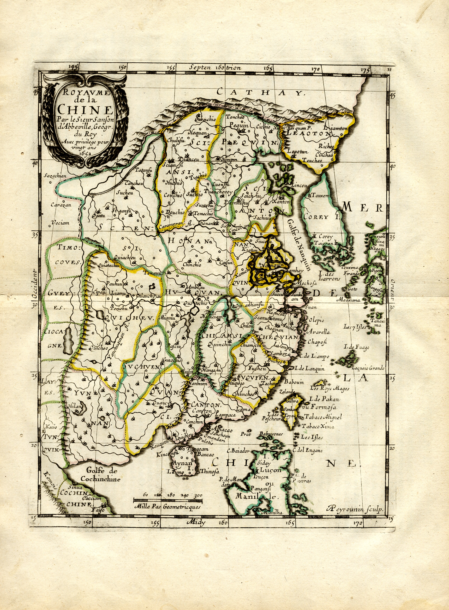
Figure 5.4 Nicolas Sanson d’Abbeville, Kingdom of China, from L’Asie, Paris,1658 edition, National Library of France, Paris.

Figure 5.5ab Top: Nicolae Milescu Spatharius, Map of Siberia, Harvard University, Houghton Library, Cambridge, MA. Bottom: Antoine Thomas, Tabual Geographica Orientis, 1690, ARSI, Jap. Sin. 110.
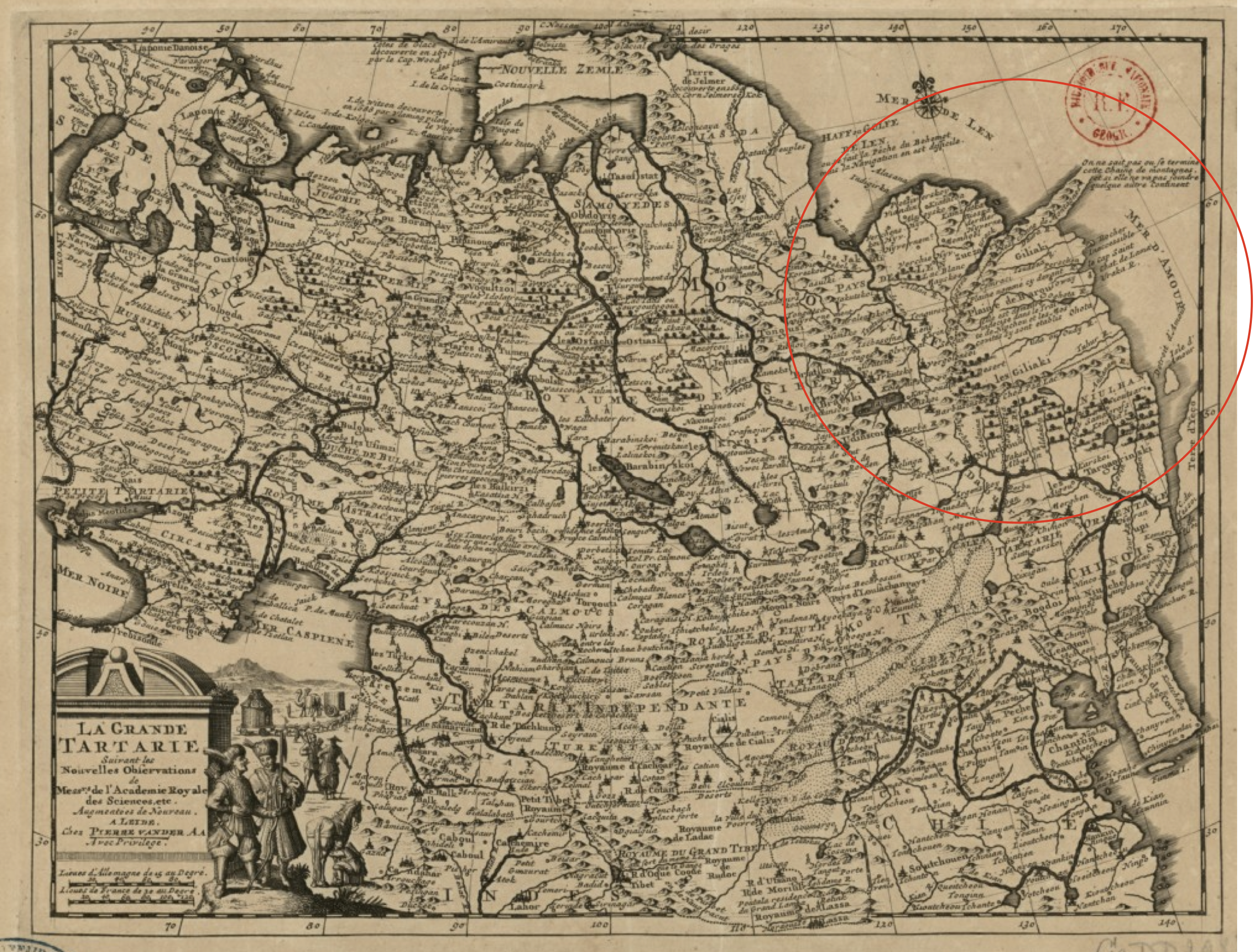
Figure 5.6 Jean Baptiste Bourguignon D’Anville, Grand Tartary according to the novel observations of the gentlemen of the Academy of Sciences (La grande Tartarie / suivant les nouvelles observations de Mess. de l'Académie royale des sciences, augmentées de nouveau), 1714, CPL GE DD-2987 (7359), BNF, Paris, France.
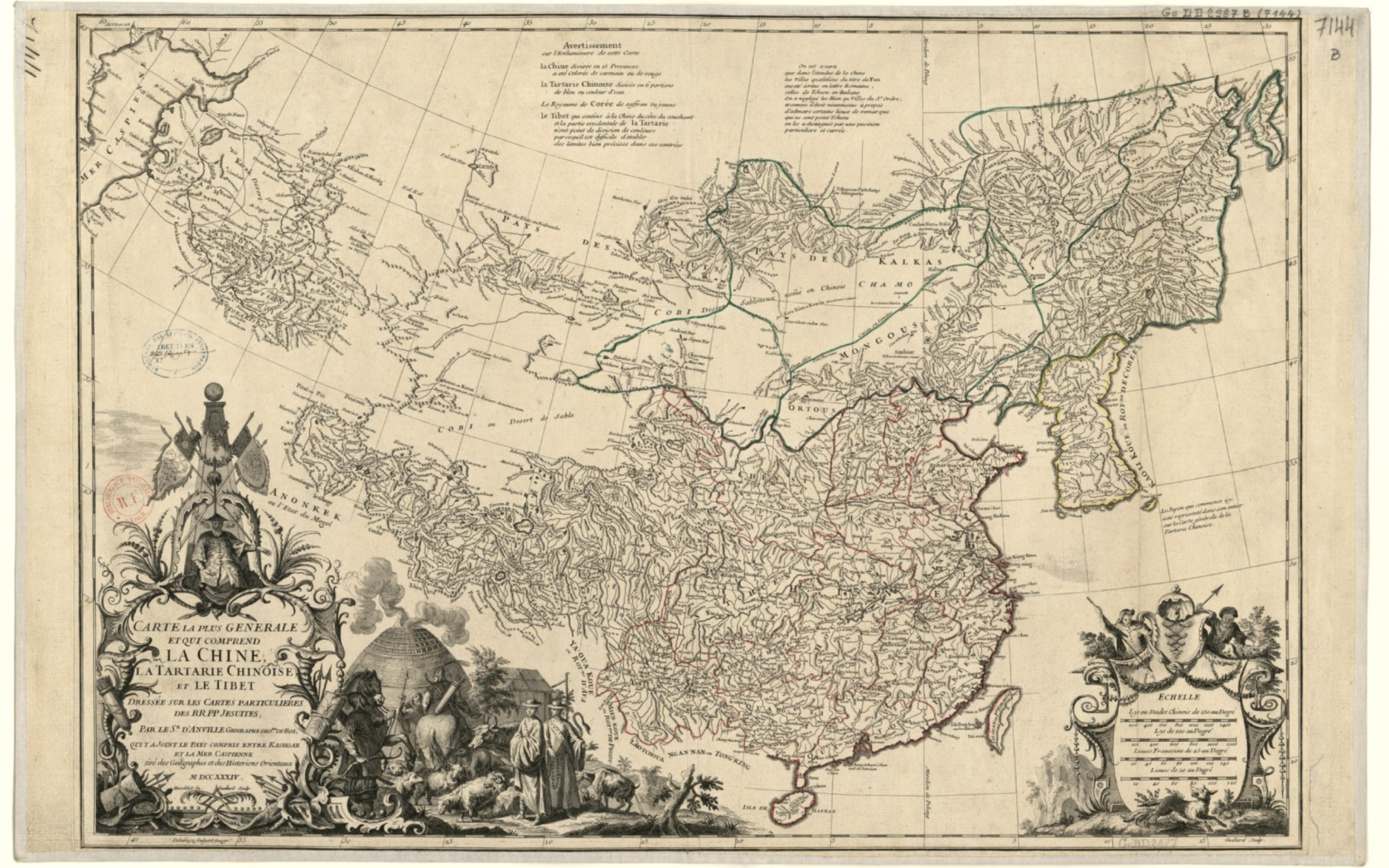
Figure 5.7 Jean Baptiste Bourguignon D’Anville, Most general map that comprises China, Chinese Tartary, and Tibet (Carte la plus generale et qui comprend La Chine, La Tartarie Chinoise, et le Tibet) 1734, BNF Cartes et plans, GE C-6140 (A), Paris, France
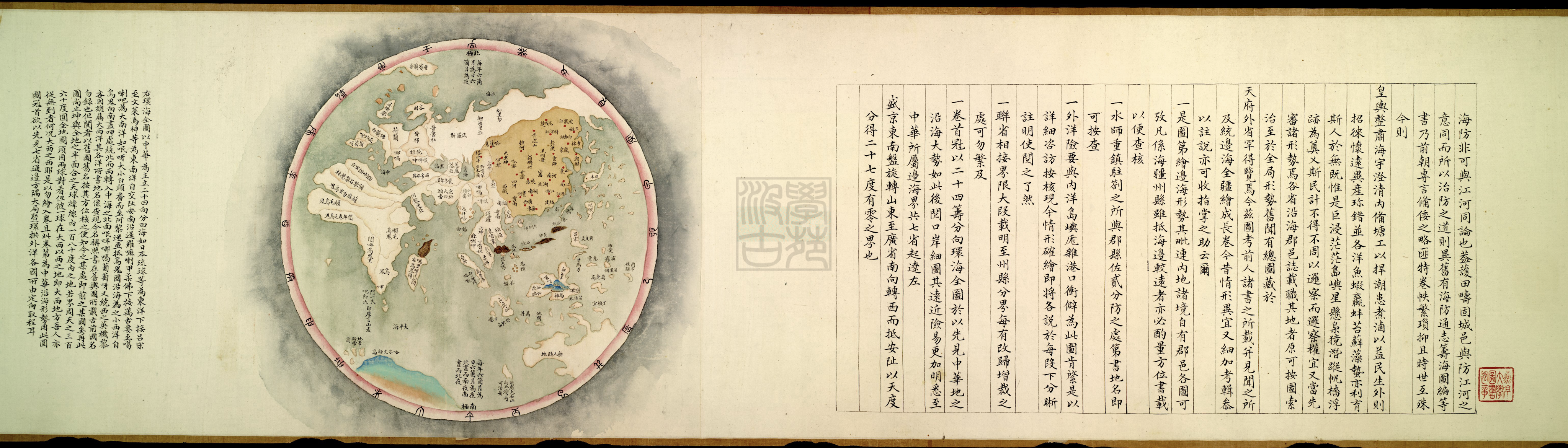
Figure 5.8 Huanhai quantu環海全圖 (Complete map of the circular ocean), from Hai jiang yang jie xing shi quan tu 海疆洋界形勢全圖 (Coastal maps of China), c. 1787, Geography and map division G7822.C6A5 1801 .H31, Library of Congress, Washington D.C. U.S.A.
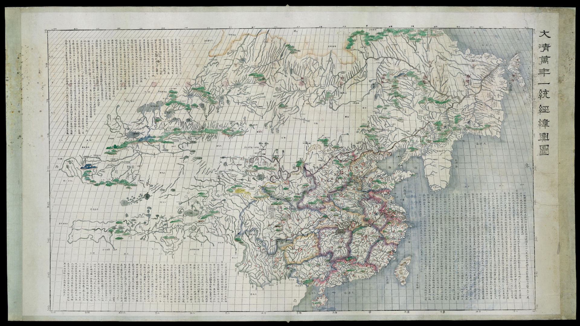
Figure 5.9 Li Mingche 李明徹 The Unified Latitude and Longitude General Map of the Ten-thousand-years Great Qing Empire Da Qing wannian yitong jingwei yutu 大清萬年一統經緯輿圖, c.1820. Niedersächsische Staats- und Universitätsbibliothek Göttingen Cod. Ms. Mapp. 34, Göttingen, Germany.
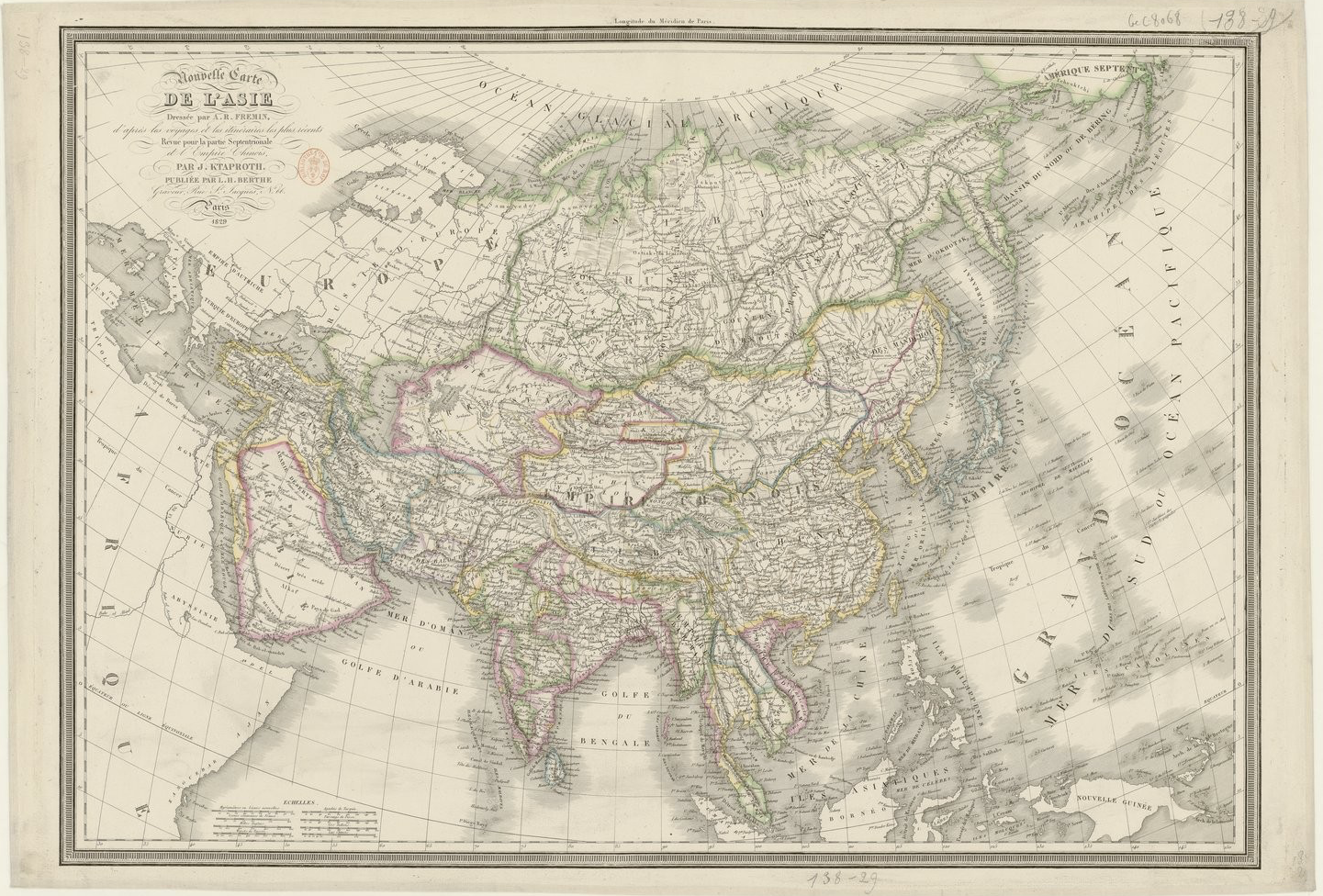
Figure 5.10 Julius Klaproth, New map of Asia (Nouvelle carte de L’Asie), 1829. BNF Cartes et plans, GE C-8068, Paris, France.
Chapter 6
China’s Place in the World
Much of the book’s narrative is dedicated to trace the complex interactions between China and Europe since the sixteenth century, but how did these interactions affect Chinese cartographers and Chinese cartographic practice? The focus of this chapter moves to the perspective of Chinese cartographers, their attitudes and uses of world maps, as well as hybrid world maps created using Western techniques and Chinese elements. The chapter demonstrates that Sino-Western world maps prompted different responses, ranging from rejection to enthusiasm and adoption. Chinese cartographers incorporated elements from these maps, cited them in their own work. Beginning with the Qianlong period of the Qing, cartographers started working with Western cartographic techniques in producing new types of maps.

Figure 6.1 Cao Junyi, Complete Map of Human Vestiges and Routes within the Nine Border Zones and the Ten Thousand Countries under Heaven, Da Ming jiubian wanguo renji lucheng quantu 大明九邊萬國人跡路程全圖. Cataloged as Map of China and Neighboring Countries, Maps and charts 60875. (11.), British Library, London, UK.
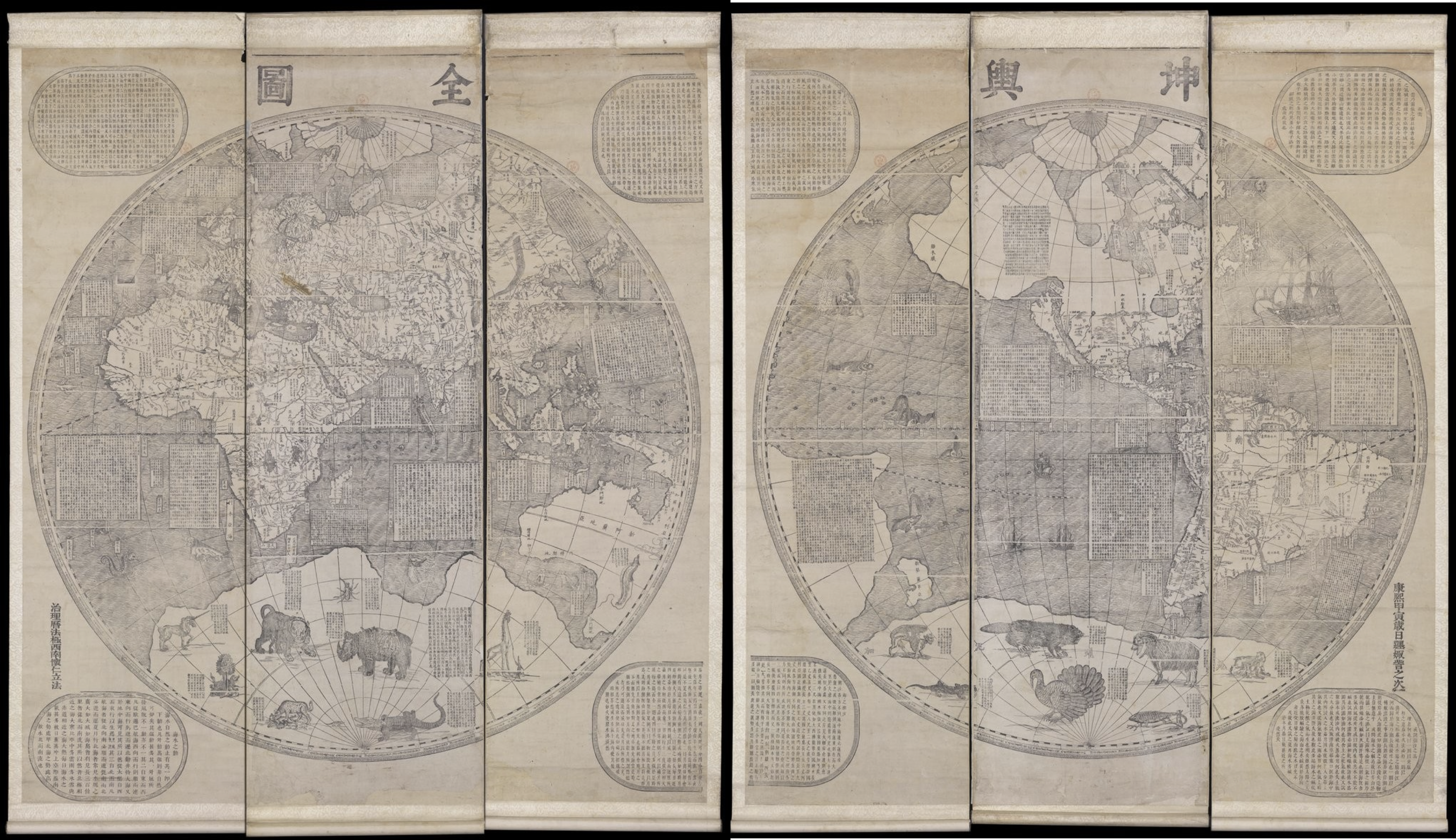
Figure 6.2 Ferdinand Verbiest 南懷仁, Complete map of the Earth (Kunyu Quantu坤輿全圖), 1674, BNFGE A-1027 (RES). Verbiest’s map was an important work of reference for Qing cartographers.
Figure 6.3 Lu Fu 吕抚, Map of the three powers, San Cai Yiguan Tu 三才一貫圖, 1722, Library of Congress, G7820 1722 .L8, Washington, DC.
Figure 6.4 Lü Fu 呂撫, Map of the Three Powers, Sancai yiguan tu 三才一貫 圖, 1722. Geography and Map Division G7820 1722 .L8, Washington Library of Congress, Washington, DC, USA.
Figure 6.5 Zhuang Tingfu, The Great Qing Dynasty World Map of TributeBearing Countries with Spherical Coordinates, Past and Present, Da Qing tongshu zhigong wanguo jingwei diqiushi 大清統屬職貢萬國經緯地球式, 1794. Library of Congress, DC. G3200 1794 .Z5, Washington, DC, USA.
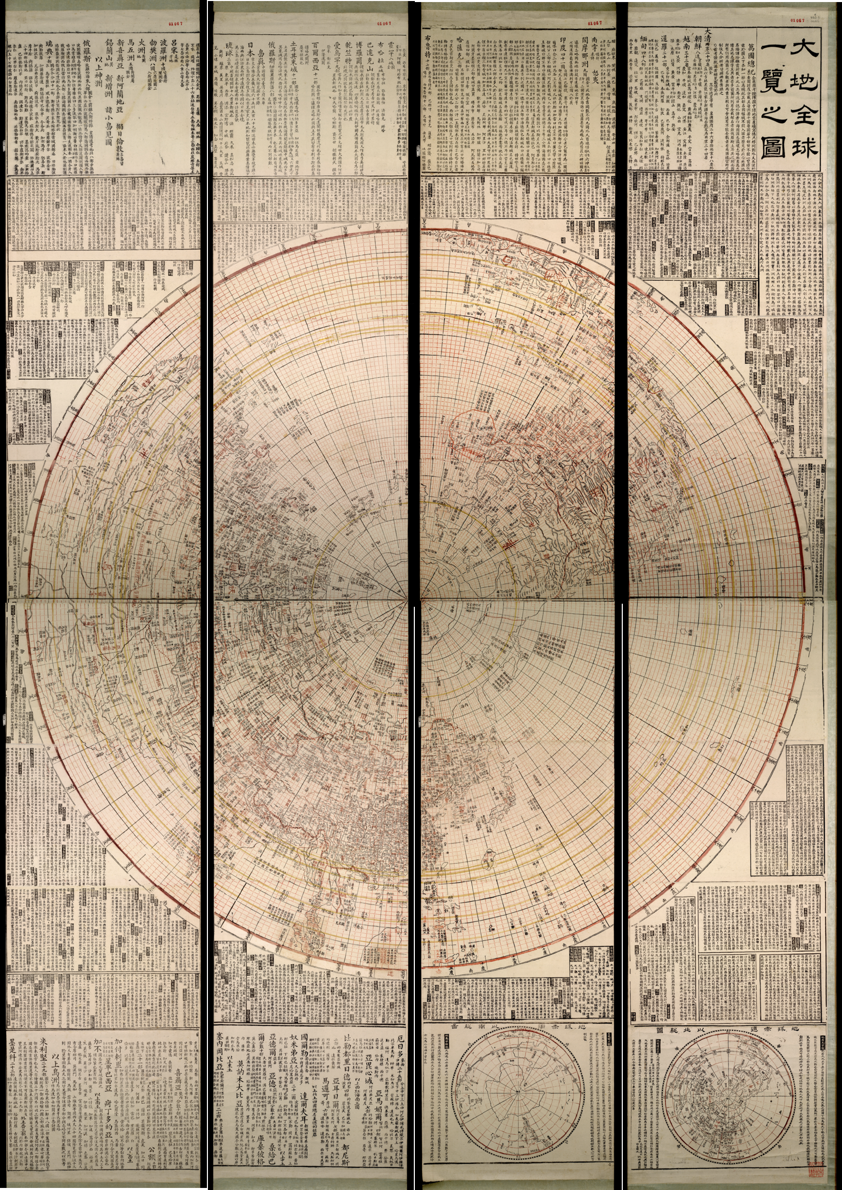

Figure 6.6a and b Ye Zipei 葉子佩 and Liu Yan 六嚴, Great map of the whole Earth at a glance, Dadi quanqiu yilan zhitu大地全球一覽之圖, 1851, Peking University Library, Beijing, P.R.C. This map is the culmination of considering information from both Chinese and Western maps. Top: Northern Hemisphere. Bottom: Detail
Epilogue
The Archipelago
The Epilogue explores the transformative impact of cartographic exchanges between the fifteenth and seventeenth centuries. The book adopted a "diving bell" approach to uncover the deep connections between Chinese and Western cartographic traditions, arguing that translation played a crucial role in shaping world geography. These exchanges led to hybrid maps and a global Renaissance, illustrating that knowledge was shared reciprocally. The chapter underscores the diverse motivations behind map translations, from territorial disputes to identity construction, and how these interactions influenced the perception of China and the West. Ultimately, the book reveals how these exchanges contributed to the modern world map and the global perspective we share today.
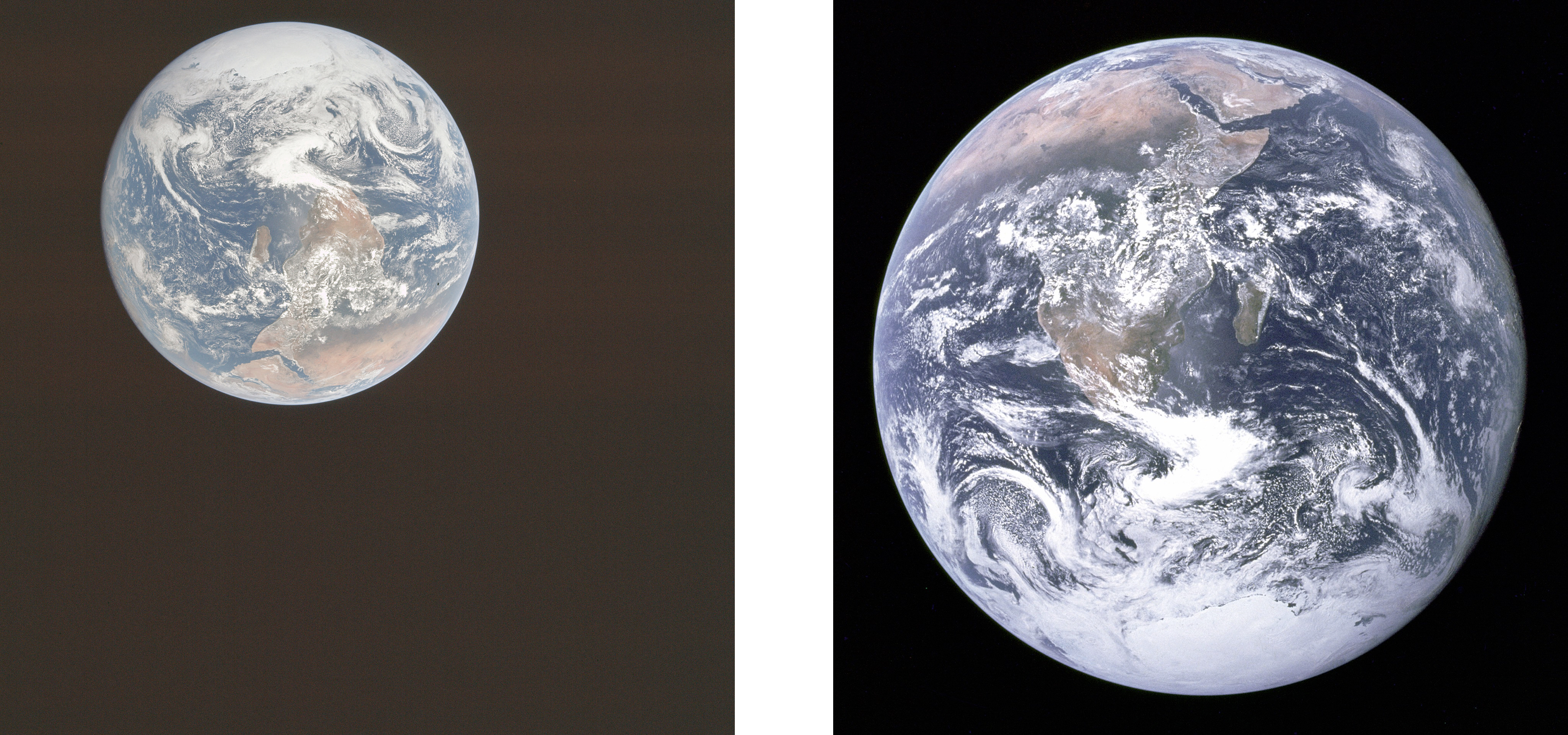
Figure 7.1 NASA AS17-148-22727 The Blue Marble. Left: Original image. Right: Popularized cropped and rotated version.