Connected Cartographies:
World Geography and the Sino-Western Translation of Knowledge, 1580-1842
Cambridge University Press, 2025
The Archipelago
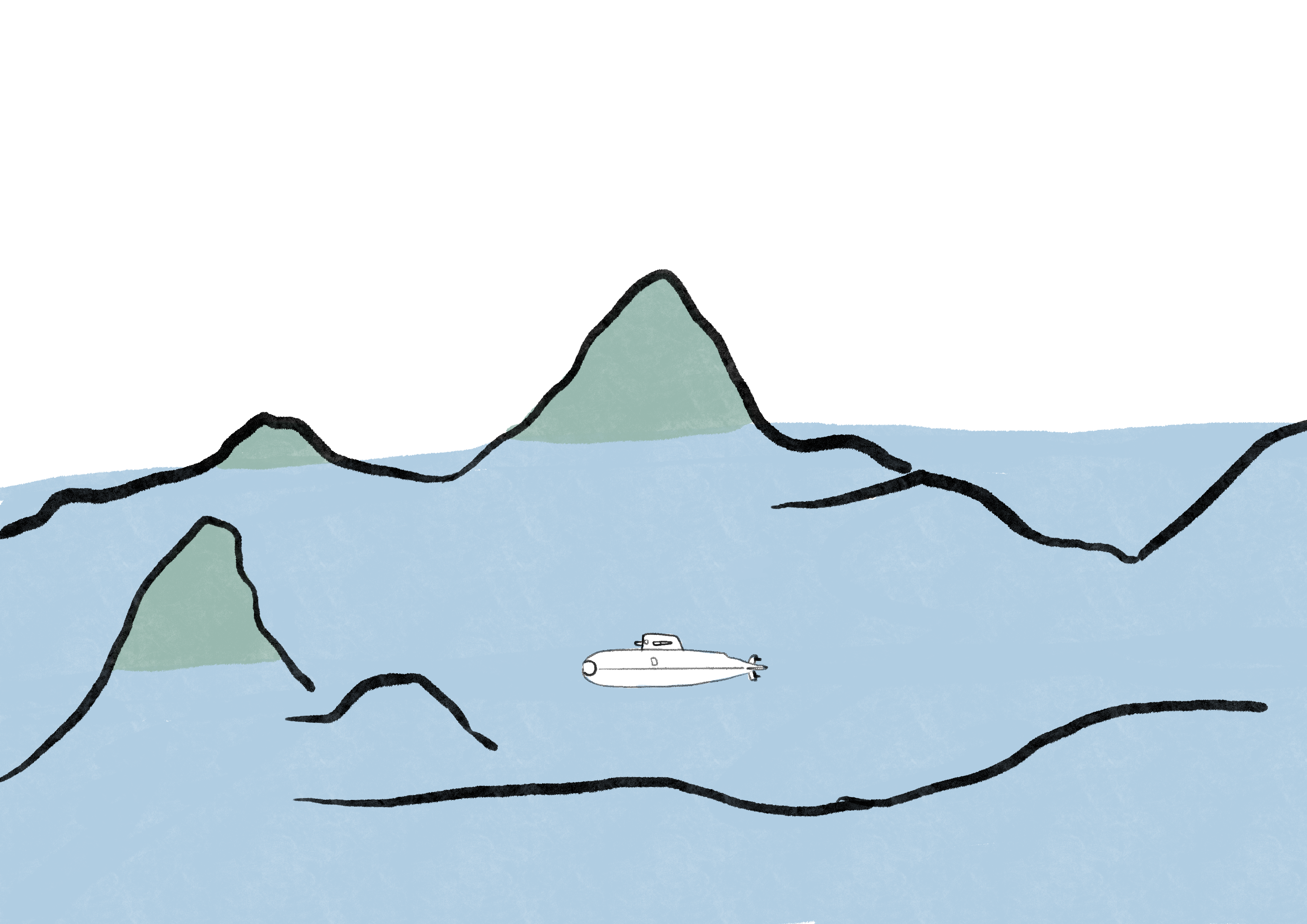
There are three ways to perceive an island chain.
1. If seen from above—a perspective that world maps and globes attempt to simulate—islands appear irretrievably separate and isolated from one another.

2. The same idea of separation is also present if you descend like a traveler to the surface, except that now, as you move, you experience each domain in sequence: land - water - land, and again water.

3. However, if you take a ride in a submarine, or perhaps a diving bell, your perspective will suddenly change. Now, you could perceive that the separation is only an illusion. What from above appeared as islands are indeed the tips of a deeply interconnected mountain chain.

The image of the archipelago describes the form of the early modern world, both in terms of geographical and cultural differences. With the benefit of historical distance, and looking from above, one can almost be certain of the neatly distinct profile of cultures and ways of being, of knowing, and of making knowledge in places such as China, Europe, the Islamicate Middle East, Africa, and the Americas. At surface level, one will encounter, as many early modern travelers did, both continuities and immense gaps between these places. But the deeper one goes under the surface, the connections still persist, even though with depth there is less sunlight to make them manifest.
World Geography in Sino-Western Encounters
︎Connected Cartographies
In the 'Age of Discovery', explorers brought a wealth of information about new and strange lands from across the oceans. Yet, even as the Americas appeared on new world maps, China remained a cartographic mystery. How was the puzzle of China's geography unravelled? Connected Cartographies demonstrates that knowledge about China was generated differently, not through exploration but through a fascinating bi-directional cross-cultural exchange of knowledge. Florin-Stefan Morar shows that interactions between Chinese and Western cartographic traditions led to the creation of a new genre of maps that incorporated features from both. This genre included works by renowned cartographers such as Abraham Ortelius and Matteo Ricci and other less-known works, 'black tulips of cartography,' hidden in special collections. Morar builds upon original sources in multiple languages from archives across three continents, producing a pioneering reconstruction of Sino-Western cartographic exchanges that shaped the modern world map and our shared global perspective.
Reviews
‘Morar carries forward recent shifts in cartographic history to challenge the idea that Europe ‘discovered' the rest of the world by looking closely at how cartographers, both European and Chinese, crossed cultures as they put the world together on paper.'
Timothy Brook - University of British Columbia
In this masterful study, Morar charts how translation and adaptation-not just exploration-crafted early global perspectives in both China and Europe. ‘Connected Cartographies' offers a fresh perspective on how Jesuit maps, Manchu border policies, and Qing expansion reshaped the meaning of ‘empire' and ‘border' itself, underscoring the importance of hybrid cartographic traditions for modern global history.
Hyunhee Park - The City University of New York
‘Connected Cartographies' offers a compelling narrative of the interactive co-emergence of early modernity in China and Europe in the fields of world geography and cartography.
Qiong Zhang - Wake Forest University